


Version 3.7 offers the Effective date upload field for files and maps. This can be useful for measurements or interpretations linked to a past date such as data acquisition date. By default, the date is set to the day of upload, but can be changed to a past one. Effective dates can also be used as a search filter in the File manager and in the Maps/plans/sections pages.
Note: Data imported prior to version 3.7 will be set to match the upload date but this field can be edited any time.

Previous tips can be found under the Software tip category in the Resources section and in the Archives section of our website.
Latest news

Using Python with Geoscience ANALYST
A new Geoscience ANALYST Python API, providing the capability of connecting to open source software, is scheduled for release....

R&D project with UDMN
We have been awarded a major R&D project from the Ultra Deep Mining Network (UDMN) called “4D Real-Time Geotechnical Hazard Assessment and Reporting”.

Using magnetic susceptibility measurements to define mineral exploration targets
Combining magnetic survey data with measured drillcore susceptibility data greatly increases the resolution and geometrical accuracy of the magnetic inversion...

GEOH5 open format
We developed geoh5 based on free and open-source HDF5 technology because of its many advantages: wide acceptance across numerous data-intensive industries...

What’s new in Geoscience ANALYST version 4.0 – Virtual Lecture
Watch as Carla shows the new and updated tools in Geoscience ANALYST 4.0...
Building a greenfields project from public data in Geoscience ANALYST Pro – Virtual Lecture
See recording - Gem shows how Geoscience ANALYTS is a great tool to do exploration without getting your boots dirty...

GOCAD Mining Suite – A geological modelling powerhouse
Past event, recording link available here...

3D seismic data
In Geoscience ANALYST you can import and visualize 3D seismic data, and plan your next seismic survey with the seismic reflection survey designer....
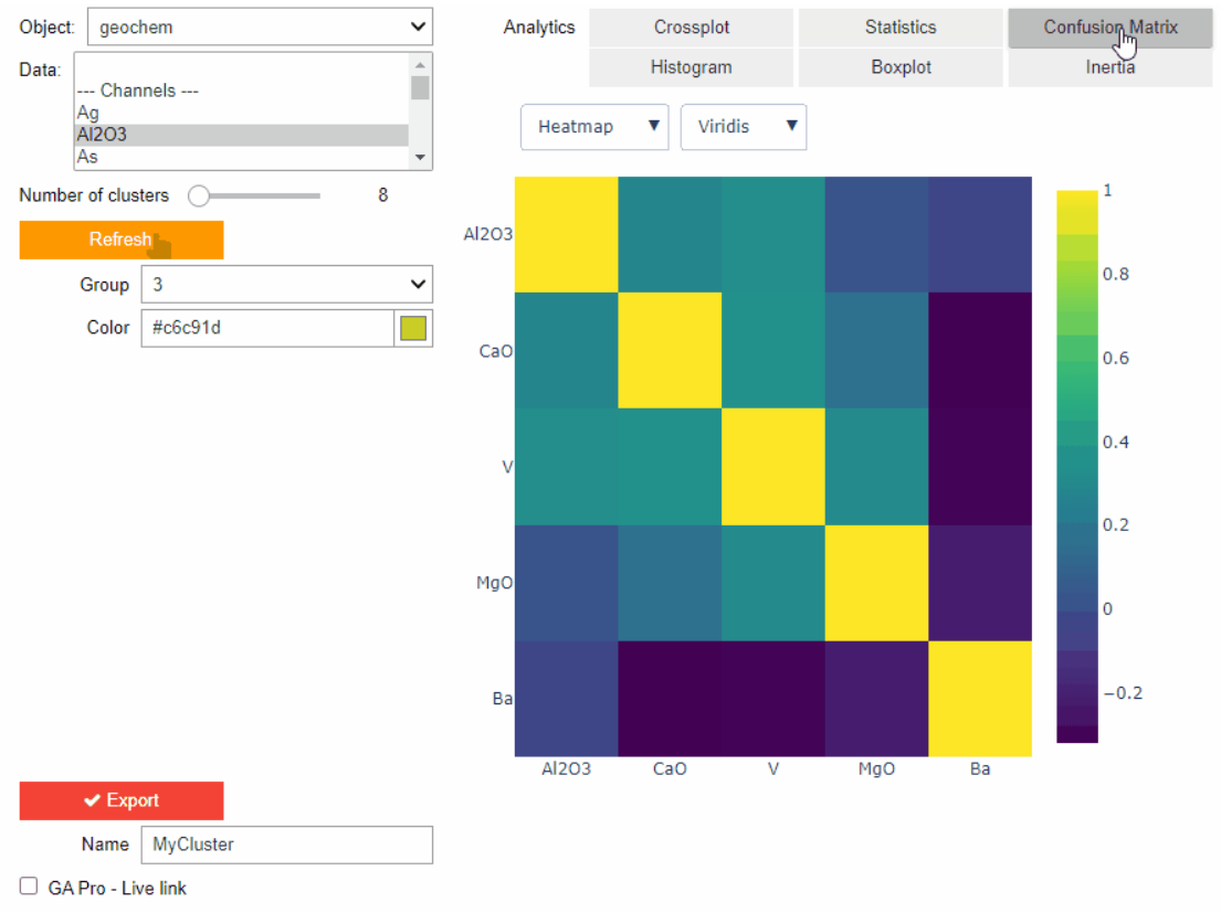
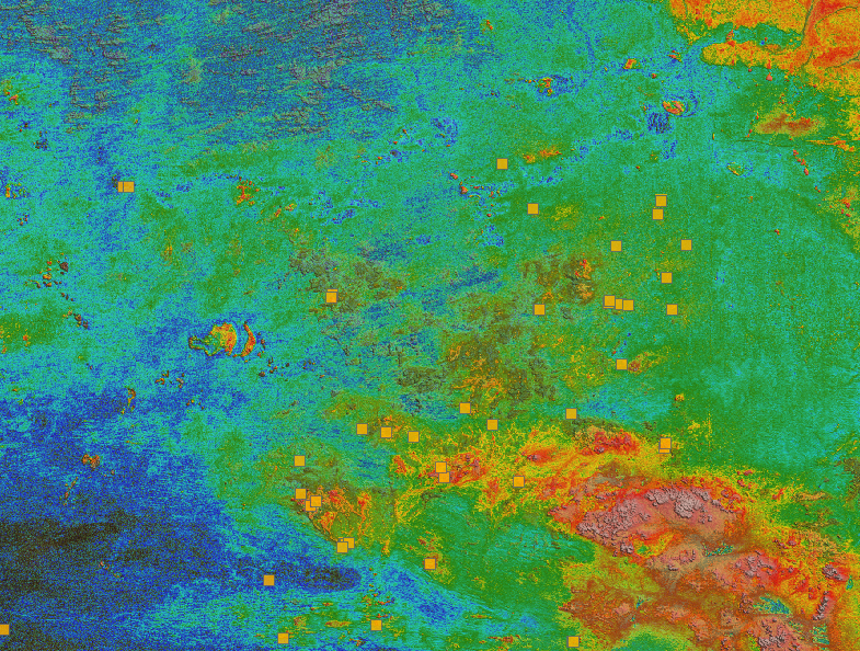
Clustering data stored on geoh5 objects
Past event. View here or on our YouTube channel...

Show and hide
In Geoscience ANALYST you can show and hide everything, individual objects, container groups or drillhole groups...

Creating 3D geological starting model from geological maps and structural measurements
In this lecture, Philippe generates a 3D geological model from a map with structural measurements in Geoscience ANALYST...

Dynamically turn on/off classes in scatter plots
In Geoscience INTEGRATOR, you can turn on/off classes in scatter plots...