New release – Geoscience INTEGRATOR 4.1
Geoscience INTEGRATOR 4.1 unveils a range of new features and improvements designed to boost performance and enhance user experience.


”Geoscience INTEGRATOR acts as a centralized hub for validated, version-controlled data. It’s where all your structured and valuable unstructured data lives—images, well logs, reports with critical metadata, etc. That’s the stuff you need to make your interpretations more accurate and your workflows more efficient.
—Gem Midgley, Principal Consultant at Mira Geoscience
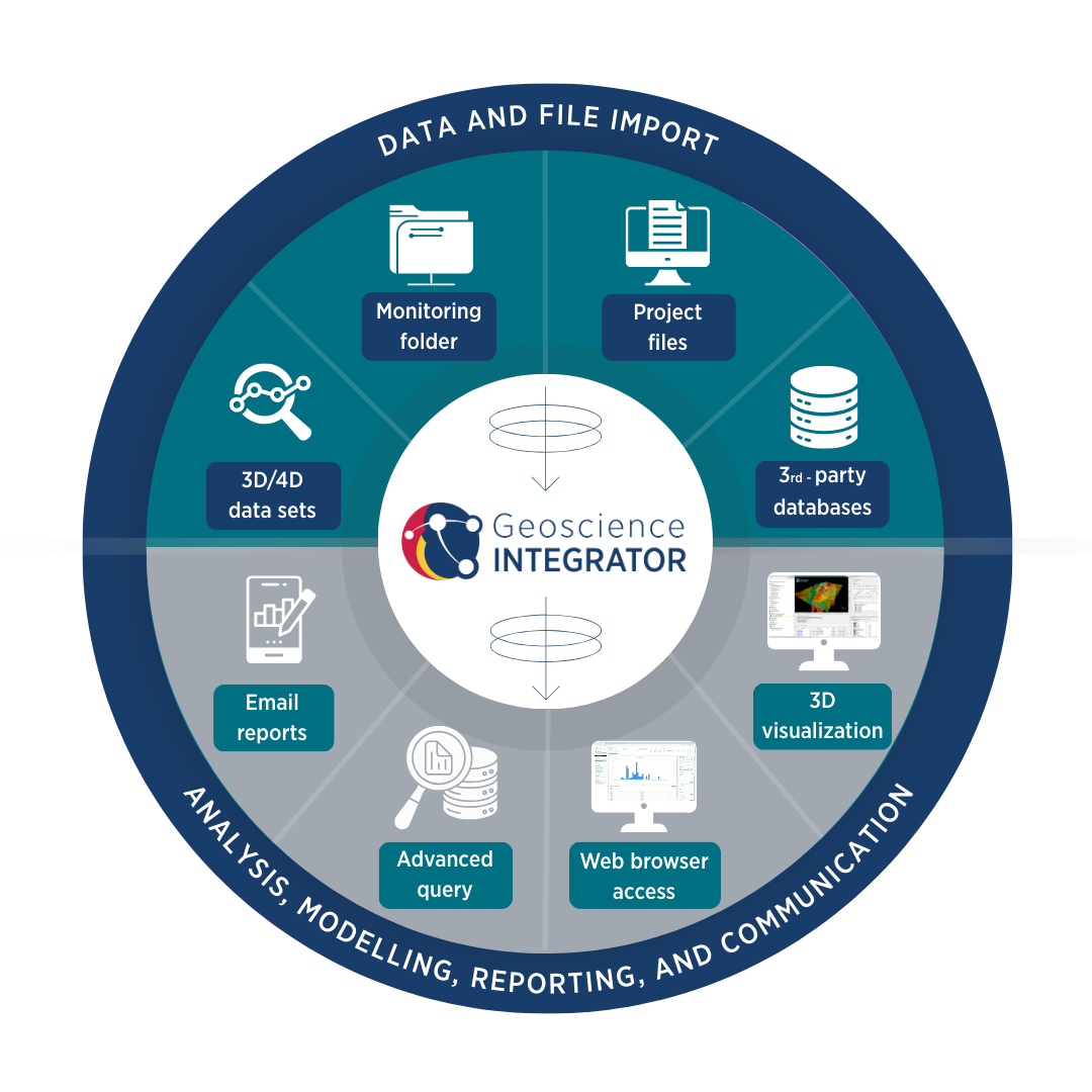
Efficient exploration begins with reliable data. Geoscience INTEGRATOR provides a central platform for storing, organizing, and securing your exploration datasets—no matter the size or complexity. It seamlessly handles drilling results, geological interpretations, geophysical surveys, geochemistry, and more, ensuring all information is readily accessible and consistently formatted. With built-in metadata management, audit trails, and version control, you can trust your data’s integrity across the project lifecycle.
Centralized data repository for all exploration datasets
Single, validated source of truth for project teams
Strong data integrity with metadata management and audit trails
Version control to track updates and maintain transparency
Harmonization of multi-source, multi-format datasets
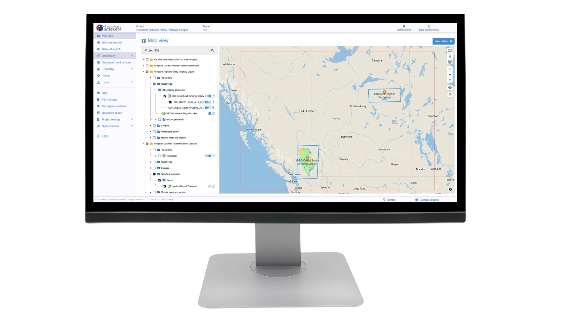
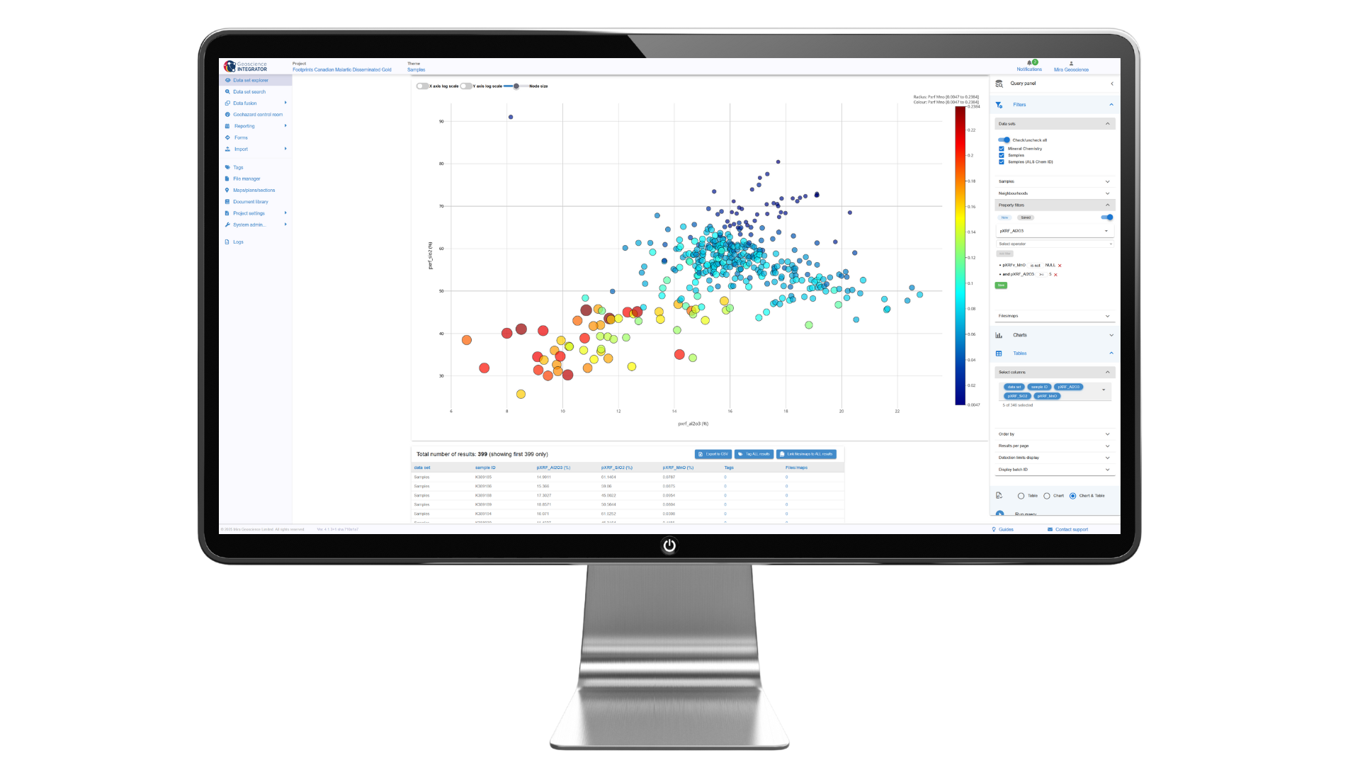
Unlock the value of your data with powerful and flexible querying tools. Geoscience INTEGRATOR enables users to search across multiple datasets and disciplines in seconds. Advanced filtering and query-building capabilities make it easy to extract exactly what you need—whether that’s drillhole intervals with specific assays, geophysical anomalies within defined bounds, or integrated datasets spanning multiple themes. By supporting both simple keyword searches and complex conditional queries, the system ensures that answers are always at your fingertips.
Rapid search across all exploration datasets
Flexible query builder for both simple and advanced criteria
Filter results by geology, geochemistry, geophysics, drilling, and more
Retrieve integrated, cross-disciplinary insights with ease
Reduce redundancy and unlock hidden connections in your data
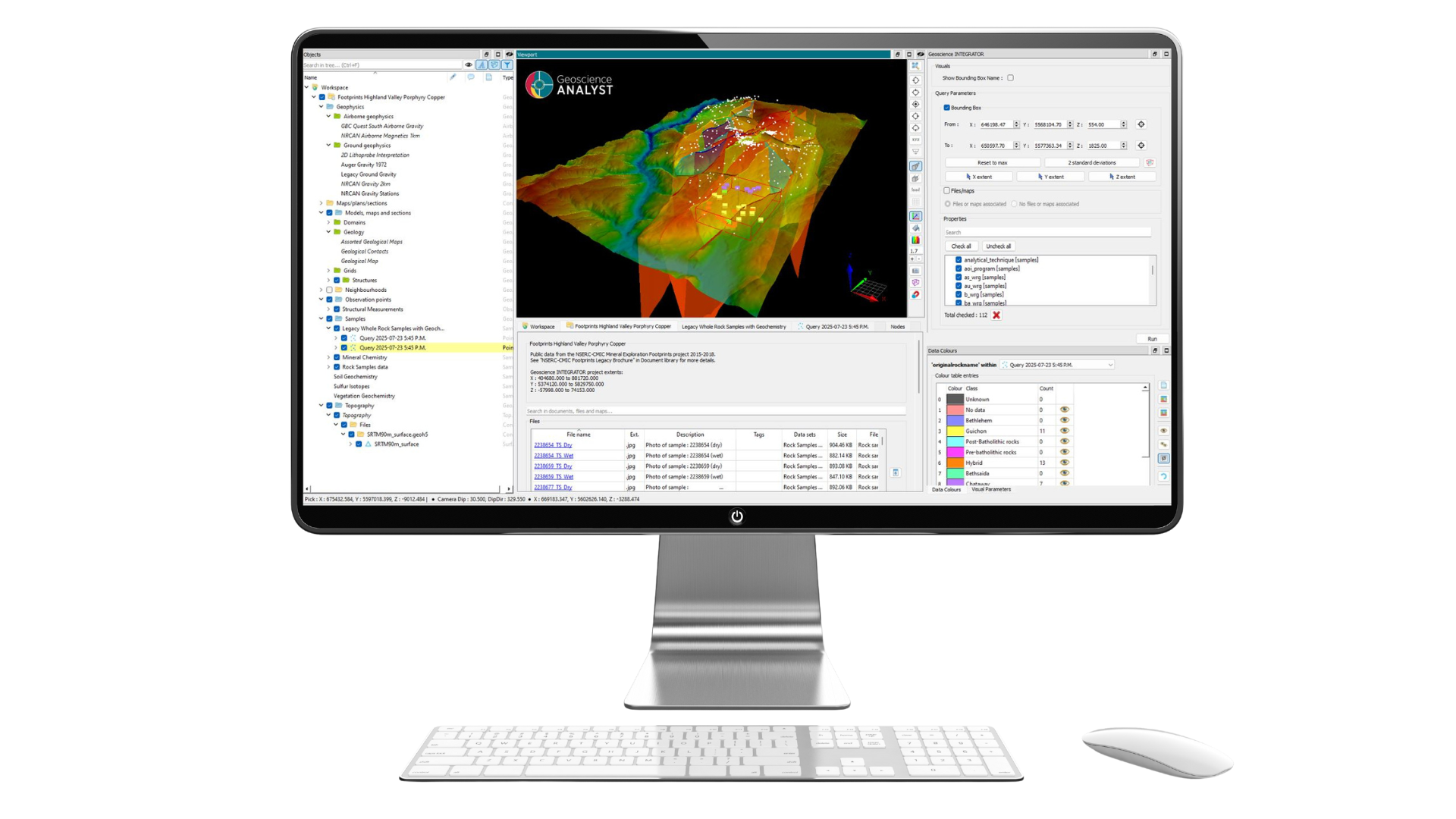
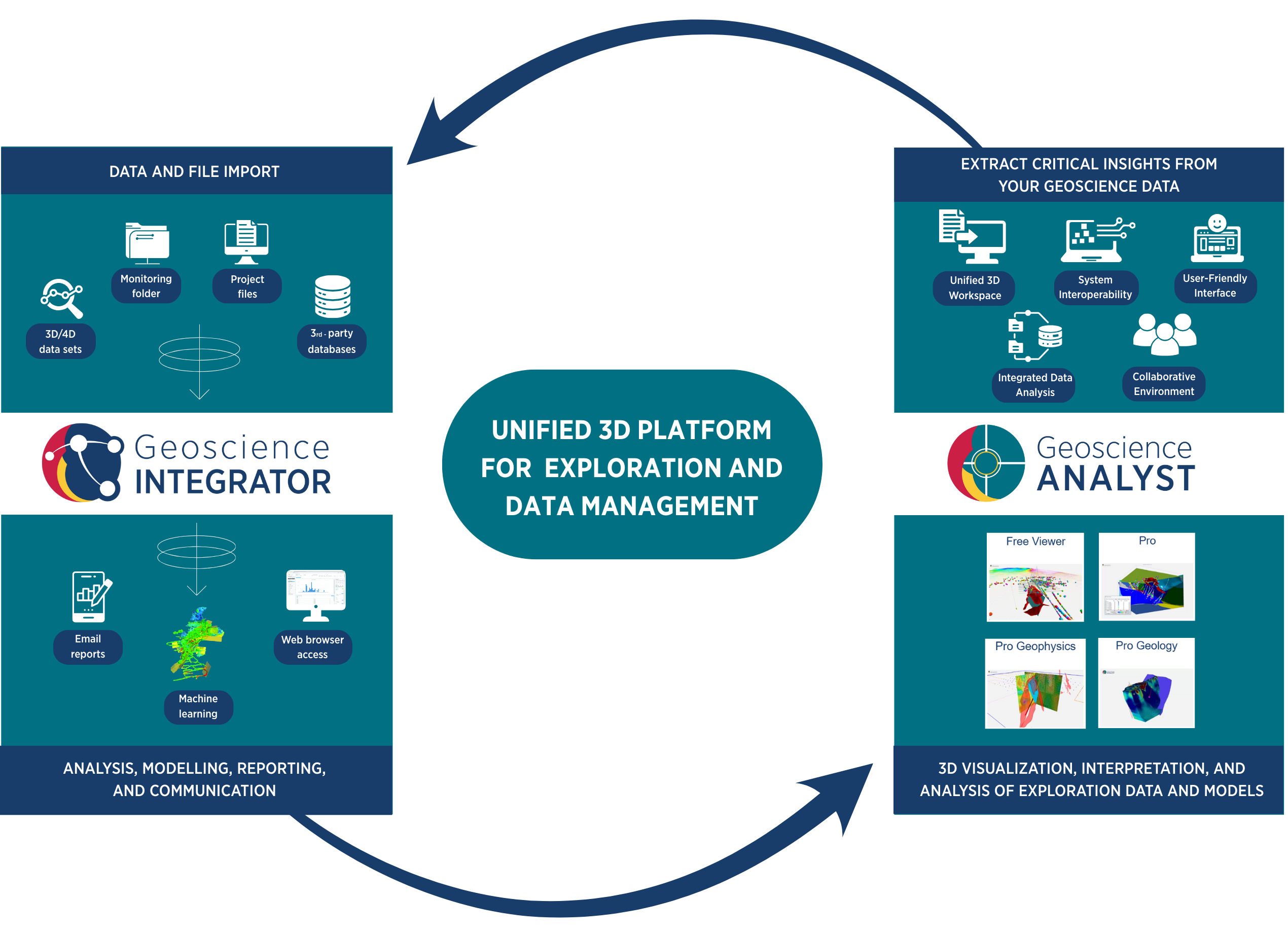
Geoscience INTEGRATOR consolidates exploration data and models for direct visualization in Geoscience ANALYST—its fully integrated, intuitive 3D desktop environment. Geoscience ANALYST equips teams with interactive tools to explore relationships, identify trends, and validate interpretations. It drives collaboration across disciplines, reveals insights, and improves communication with stakeholders at all levels of expertise.
Many exploration teams already rely on Geoscience ANALYST for powerful, intuitive 3D visualization, processing, and interpretation. But its true value depends on the quality, organization, and accessibility of the underlying data. That’s where Geoscience INTEGRATOR comes in.
By introducing Geoscience INTEGRATOR into your workflow, you move from visualizing and interpretation in isolation to working with a centralized, validated source of truth. This ensures that every 3D interpretation in Geoscience ANALYST is based on consistent, up-to-date information—eliminating version conflicts, missing files, and the inefficiencies of chasing down data.
Combining Geoscience INTEGRATOR with Geoscience ANALYST streamlines the entire exploration workflow. Data flows seamlessly from secure management to interactive 3D visualization, enabling faster queries, stronger cross-disciplinary collaboration, and greater confidence in decision-making. Together, Geoscience INTEGRATOR and Geoscience ANALYST offer a powerful, 3D integrated platform for mineral exploration and data management.