


In the upcoming Geoscience INTEGRATOR v3.6, you can carry out various operations on multiple files simultaneously, such as edit, delete, download, and associate tags and data sets through the File manager and the Maps/plans/sections pages.

Previous tips can be found under the Software tip category in the News section and in the Archives section of our website.
Latest news

Q&A: Revival Gold Inc.
We discussed Mira Geoscience’s contribution to further understand the Beartrack-Arnett gold project area using modern exploration techniques...


Manual classifications vs Project classifications
In Geoscience INTEGRATOR, There are two ways to create classifications when importing data...

Macros
In GOCAD Mining Suite you can save lots of time with SKUA-GOCAD’s macros, a built-in scripting tool in which you can record or enter a sequence of commands to carry out or repeat at any time...

R&D projects in data management
Over the past couple of years we have been developing skills and technology in practical, business-focused data management as a solid foundation for modelling, analysis, and interpretation.
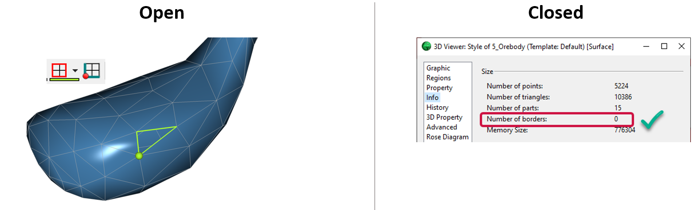
Is the surface opened or closed?
In GOCAD Mining Suite you can easily know if your surface is opened or closed by...

Editing file settings
In Geoscience INTEGRATOR version 3.4, users will be able to edit their files’ settings...

Using Python with Geoscience ANALYST
A new Geoscience ANALYST Python API, providing the capability of connecting to open source software, is scheduled for release....

Editing property’s colormap
In GOCAD Mining Suite, when you select a property its colormap can be edited...

3D seismic data and survey designer tools
Coming soon to Geoscience ANALYST, tools for hard rock seismic...

Inverting time domain data in Geoscience ANALYST version 4.0 – Virtual Lecture
Kristofer inverts TEM data in 1D through Geoscience ANALYST Pro Geophysics to recover conductivity in Geoscience ANALYST 4.0...

Sneak peek v19
Emerson-Paradigm released a short video to help users become acquainted with the redesigned interface. Watch this short video ...