Geological models you can trust
Software and consulting services delivering the most advanced geological modelling, interpretation and data management solutions for mineral exploration and geotechnical hazard assessment.
Contact usMineral exploration consulting
From software training to model construction to senior project advisors, we provide specialized geological consulting services in modelling that fully incorporates geophysical data, exploration drillhole targeting, data management, and machine learning for exploration and geotechnical reports and objectives.
Learn moreGeological & geophysical software products
Browse through our catalogue for integrated, quantitative, and multi-disciplinary 4D and 3D geological modelling software, data management solutions, geophysical forward modelling and inversion codes, and geohazard assessment applications.
Learn moreGeoscience news & insights


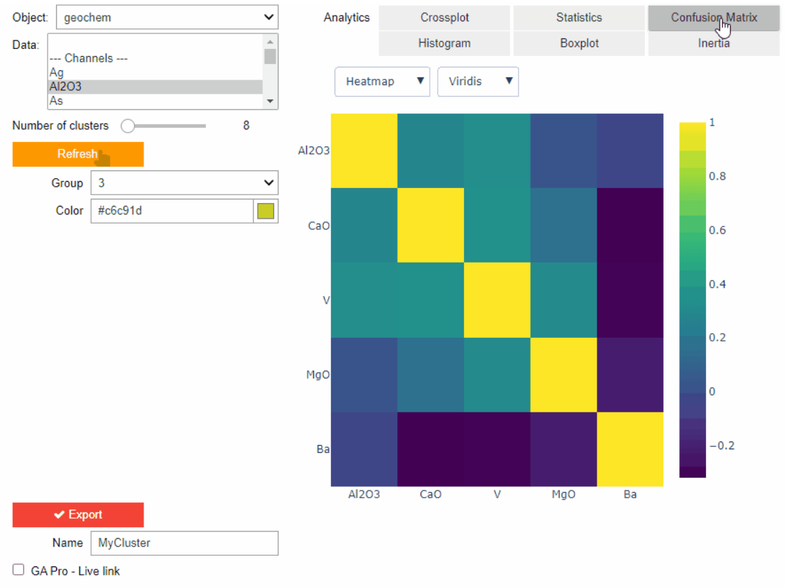
Clustering data stored on geoh5 objects

A YouTube Channel about 3D modelling

Let the data speak!

Drag-and-drop files into a 3D compilation

Mira Geoscience receives the 2023 AME Innovation Award

Including water bodies in gravity and magnetic inversion modelling – Geoscience ANALYST Pro Geophysics

Q&A Mineral Resources Tasmania

Geological 3D-GIS query

Effective date field

Deep Learning as an alternative to downward continuation filters for structural interpretation

About us
Advanced 3D modelling and data management solutions
Mira Geoscience stands for technology and solutions for best geoscience-based business decisions. Your return on investment is at the heart of all the strategies our geological services company employs for you. Since 1999, we have pioneered the application of advanced geological modelling, 3D-GIS technology, and 4D multidisciplinary data management in the mining industry through the integrated “Common Earth Model”. We count numerous geological survey organizations and universities amongst our clients, providing a collaborative environment for and technology development.
We supply the mining industry with practical and cost-effective multi-disciplinary 4D and 3D geological modelling and data management solutions for mineral exploration and geotechnical hazard assessment. Our client list includes most of the world’s major mining and mining-industry service companies, as well as many juniors. We count numerous geological survey organizations and universities amongst our clients, providing a collaborative environment for technology development.
We have offices in Montreal, Vancouver, Sudbury, Brisbane, and Perth, and work with an extensive network of mining-industry technical experts (geoscientists, geophysicists, geologists, geophysical consultants, etc.) to bring the right team to 3D geoscience project challenges.
They trust us


