


The Sample compilation page offers powerful tools to support the analysis of complex or difficult-to-view relationships within your sample data. It compiles the data from multiple sources to obtain information that is more useful than what individual data sets can provide. It saves time and limits the risk of error caused by performing the tasks required to bring this data together manually.
The Details tab provides access to all the sample-related data for each Sample ID, regardless of the themes or data sets each sample and property belong to.

You can also generate charts and tables using any of the samples’ properties.

Previous tips can be found under the Software tip category in the News section and in the Archives section of our website.
Latest news

Data display precision
In Geoscience ANALYST Data Colours panel you can control the precision of the data...

Documents linked to a project
When documents are linked to a project in Geoscience INTEGRATOR, it is possible to be more specific and link them to the project’s data sets...


Using comment field entries in drillhole databases to automatically re-log lithologies
This approach uses the comment field of the logging table to extract general topics that can then be used as learning features in a supervised machine learning classification approach.

Extracting property names from a CSV
In Geoscience INTEGRATOR, extract the property names directly from a CSV file to speed up the process and reduce errors...

Mira Geoscience Partners with Tessael to Advance Geological Modelling in Geoscience ANALYST
Capture geological observations quickly, safely, and accurately, both in the field and office with HiveMap...

Operations on multiple files
In Geoscience INTEGRATOR, you can carry out various operations on multiple files simultaneously...

Easily display a property on multiple objects
In GOCAD Mining Suite objects are grouped by the properties they contain...
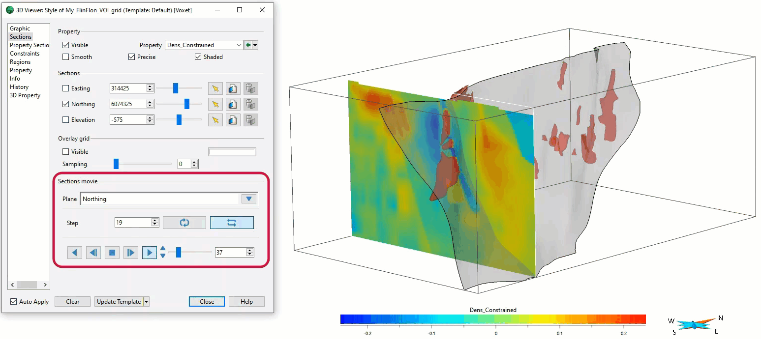
Sections movies
In GOCAD Mining Suite, you can create a section animation by specifying which section plane you want to visualize...

Copying objects between Workspaces
In Geoscience ANALYST objects can be copied from one Workspace to another by using Ctrl+C and Ctrl+V...

Monitoring folders
Geoscience INTEGRATOR's monitoring folders can be used to automatically import files to a project to save time and streamline regular updates.

Importing objects from project
In GOCAD Mining Suite you can easily import objects from one GOCAD project to another by...