


The Script on Object Property utility in Geoscience ANALYST Pro can be used in a wide variety of geoscientific applications.
You could, for example, compute alteration indices from geochemical assays, using standard operators, and combine these alteration indices to define a high alteration zone, using logical if/then statements. Scripting functions can be found in the help tool.

You could also normalize object data within a given range, invert for the anomalous density of a geology model, and more. Have a look at this how to video.
Geoscience ANALYST Pro offers low-cost tools for interpretation, targeting, and geophysical inversion. Activate your 10-day Free Trial now through the user interface.
Previous tips can be found under the Software tip category in our News page and in our Archives page.
Latest news

DC resistivity inversion in Geoscience ANALYST Pro Geophysics
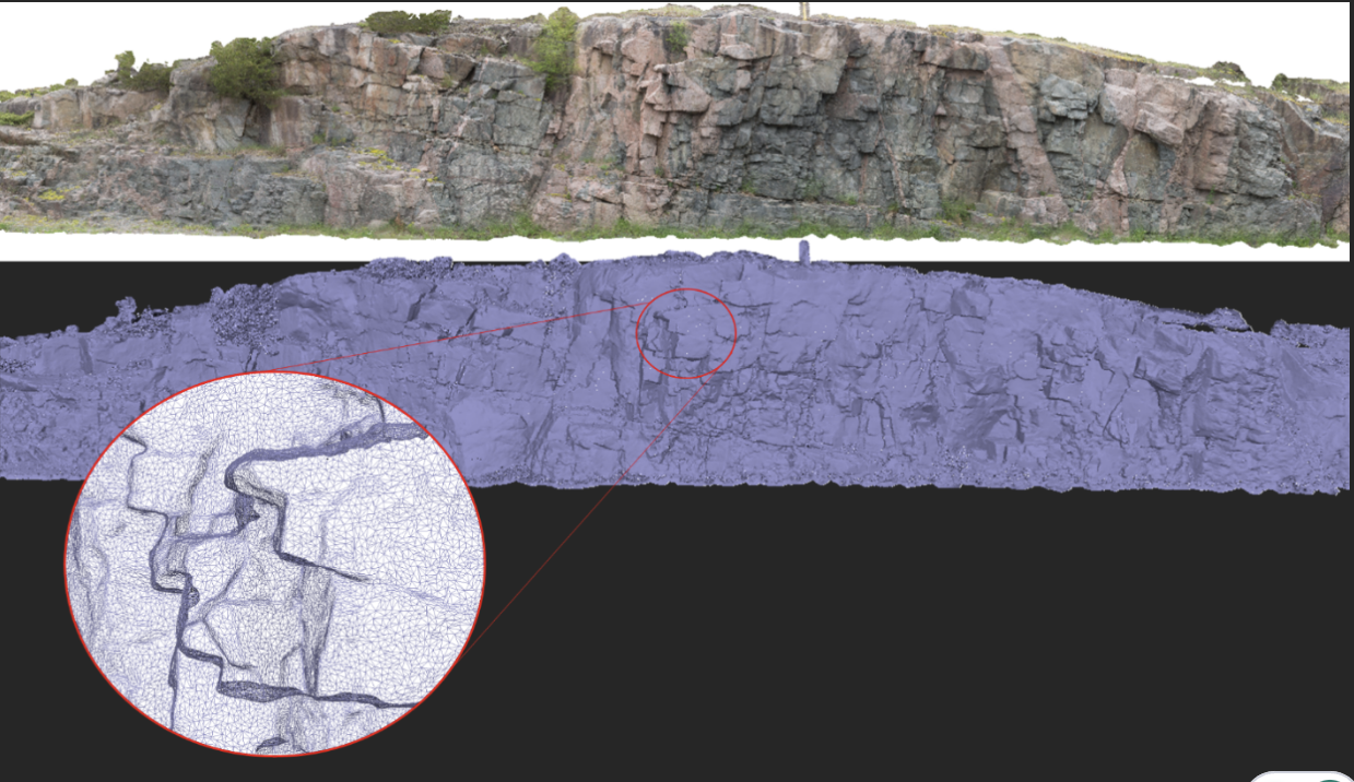
Creating Mappable Surfaces
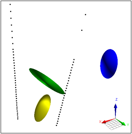
Parametric Ellipsoid Modelling in Geoscience ANALYST Pro Geophysics

Including water bodies in gravity and magnetic inversion modelling – Geoscience ANALYST Pro Geophysics

Inverting time domain data in Geoscience ANALYST version 4.0 – Virtual Lecture

Project locks

Python applications for geoscientific problems

Editing property’s colormap
