


The construction of geological models
Available on our YouTube channel
In this lecture, Jean-Philippe Paiement showed how the attribution of probabilistic lithologies to a SKUA-GOCAD implicit model geologic grid provides the optimal modelling output. This grid allows the user to infer unknown quantities, adapt the geological volume outputs, make predictions, and learn from the data. Each model cell can provide detailed stratigraphic, probabilistic lithology estimation (e.g., 90% probability of being a granite, 10% of being a sandstone) and rock property or analytical data estimation (e.g., lithogeochemistry). This provides critical uncertainty estimation for drillhole targeting, resource assessment, and other model outcomes. The combination of advanced nonlinear geostatistics and stratigraphically, faulted accurate models makes for a powerful interpretation tool for geologists.
Notes about the software:
SKUA-GOCAD implicit modelling is a powerful solution for 3D interpolation, analysis, modelling, and data management and interpretation. It allows you to faithfully represent uncertainty in your model structure, parameters, and noise in your data. It is perfect for the modelling of complex fault networks and stratigraphic horizons (with or without drillhole data). Implicit models allow you to look at or classify lithologies, interactively select and interpret the correct data, understand the various relationships, assign, and iteratively reassign “properties” within the interactive modelling environment.

Jean-Philippe is our Director of Global Consulting. He brings 10 years of mineral exploration experience including expertise in geostatistics, structural, geological, and geochemical modelling and interpretation. He is skilled in the application of machine learning to overcome geological challenges and with new methods to reduce interpretational risks with geological data. He has a wide range of experience in mineral resource estimation for precious metals, base metals and industrial minerals across diverse geological environments around the world. He obtained an MSc from Laval University. Jean-Philippe is based in Quebec-City.
Latest events and news

Sneak peek v19

New raster imports
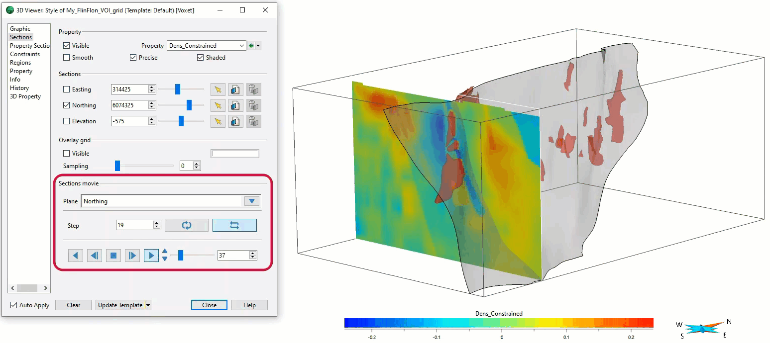
Sections movies

Search for data by spatial extent

Python API live link

UBC-GIF or VP Suite inversion?

Find and Replace

Mira Geoscience receives the 2023 AME Innovation Award

A YouTube Channel about 3D modelling

Inverting time domain data in Geoscience ANALYST version 4.0 – Virtual Lecture

Linking viewports
