


Mira Geoscience has partnered with Groupe MISA, a network of expertise in mining innovation, to develop a low-cost 3D application where all elements of drillhole design and monitoring can be accomplished within the same environment.
The current “Drillhole Designer” in Geoscience ANALYST Pro enables the creation of drillhole targets and basic drillhole design, including deviation-station editing. This project will build on top of it to create a powerful, interactive design environment with features such as advanced drillhole target definition, geometry queries, deviation design and editing, drillhole monitoring, and links to common drillhole databases.

”This project is a great example of Mira Geoscience’s commitment to the collaborative creation of advanced-yet-practical, low-cost tools for geologists, emphasizing interoperability and ease-of-use.
John McGaughey, PhD — President at Mira Geoscience
The project is a sponsored collaboration of Mira Geoscience and seven mining and service companies, with the support of the governments of Quebec and Canada to bring the results to the international market.


John McGaughey, PhD – President at Mira Geoscience
John has extensive mining industry experience focusing on quantitative, multi-disciplinary 3D and 4D interpretation for mineral exploration and geotechnical decision support. He currently leads our technology strategy and our geotechnical business.
Prior to founding Mira Geoscience in 1999, he spent 10 years at the Noranda Technology Centre as a Senior Scientist in their rock mechanics group. He obtained an MSc in geological engineering and a PhD in geophysics from Queen’s University. John is based in Montreal.
Latest news

Women Geoscientists in Canada

Python applications for geoscientific problems

Monitoring folders
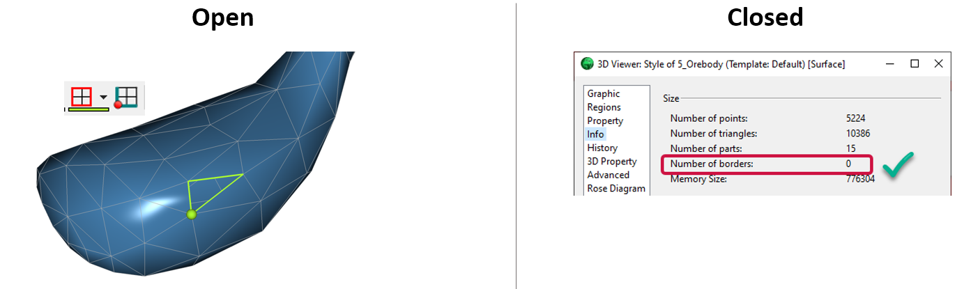
Is the surface opened or closed?

Upload global descriptions

Python API live link

Create regions – Crossplot 2D

New release – Geoscience ANALYST 4.7
