



Coloured bounding boxes are used to highlight volumes in the Viewport:
- A purple box surrounds your current selection.
- Blue-grey boxes highlight search results from the Objects panel or from the Data Set search tool.
- Yellow boxes highlight individual data sets selected from the Objects panel.
- A red box surrounds the search volume that will be used for querying.

Latest news

Women Geoscientists in Canada
We are proud sponsors of WGC, advocates for increased gender balance within geosciences...

Chasing Innovation from the Ground Up
Advances in geoscience are built on ingenuity. Circé Malo-Lalande knows it too well. Discover more about Canadian Royalties' fascinating success story.

Importing and preparing DC/IP data for inversion with Geoscience ANALYST – Virtual Lecture
In 20 mins, Kristofer shows v3.4 new functionality for pre-processing and visualization of DC/IP 2D and 3D data - Geoscience ANALYST...

Footprints project public data repository available soon
Project-generated and previously public data, models, and documents from the NSERC-CMIC mineral exploration project, “Integrated Multi-Parameter Footprints of Ore Systems...

New release – Geoscience INTEGRATOR 4.1
Geoscience INTEGRATOR 4.1 unveils a range of new features and improvements designed to boost performance and enhance user experience.

John McGaughey receives the Grahame Sands Award
John McGaughey, President of Mira Geoscience, receives ASEG's 2024 Grahame Sands Award for a career dedicated to innovation in applied geophysics.
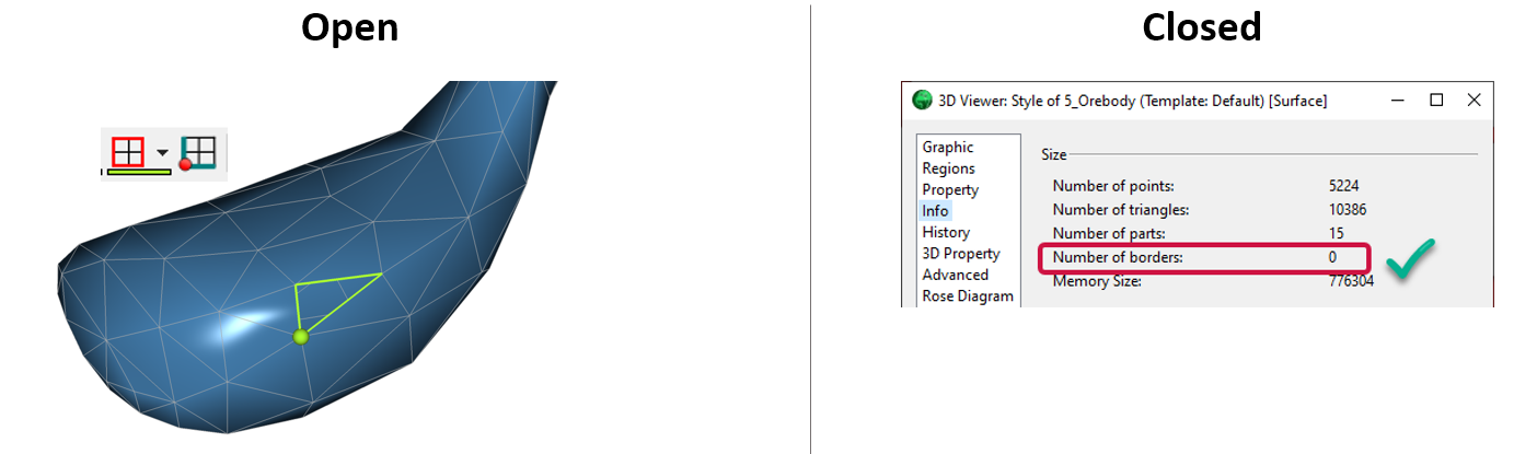
Is the surface opened or closed?
In GOCAD Mining Suite you can easily know if your surface is opened or closed by...

Taskbar icons
In GOCAD Mining Suite, icons are added to the taskbar when you open windows such as another 3D Viewer or the 3D-GIS Query panel...

Project locks
In GOCAD Mining Suite, lock files manage the reading and writing of SKUA-GOCAD projects. They are automatically created...

Coordinate system transformations
In Geoscience ANALYST Pro version 4.0, you can apply coordinate system transformations to...

Search for data by spatial extent
This video shows you how to search for data from Geoscience INTEGRATOR by spatial extent...

GOCAD Mining Suite – A geological modelling powerhouse
Past event, recording link available here...