


Learn more

GEOH5: A Framework for Geoscience Data and Model Portability
Used by thousands, GEOH5 is the open-source data structure that is taking down the interoperability barriers and revolutionizing...

Chasing Innovation from the Ground Up
Advances in geoscience are built on ingenuity. Circé Malo-Lalande knows it too well. Discover more about Canadian Royalties' fascinating success story.

Q&A with VR Resources
Join us in this exciting conversation with Michael Gunning on how to find success in blue-sky exploration through integrated interpretation of magnetic data and structural geology

A YouTube Channel about 3D modelling
We have quite a few how-to and tutorial videos lined up on YouTube highlighting our earth modelling, interpretation, and data management software for the construction of plausible geological models.

Project locks
In GOCAD Mining Suite, lock files manage the reading and writing of SKUA-GOCAD projects. They are automatically created...

Mira Geoscience receives the 2023 AME Innovation Award
John McGaughey, Mira Geoscience's President, has been selected for the 2023 AME Innovation Award for leading the development of GEOH5.

Editing file settings
In Geoscience INTEGRATOR version 3.4, users will be able to edit their files’ settings...

Rock reclassification editor
In GOCAD Mining Suite, you can simplify logging codes for modelling projects and data management using the Rock reclassification editor...

Filtering samples by their drillhole
In Geoscience INTEGRATOR, you can can filter them according to the drillhole they are located in...

Drillhole data interpretation – Geoscience ANALYST free viewer and Python
Past event, link to the recording is available here...
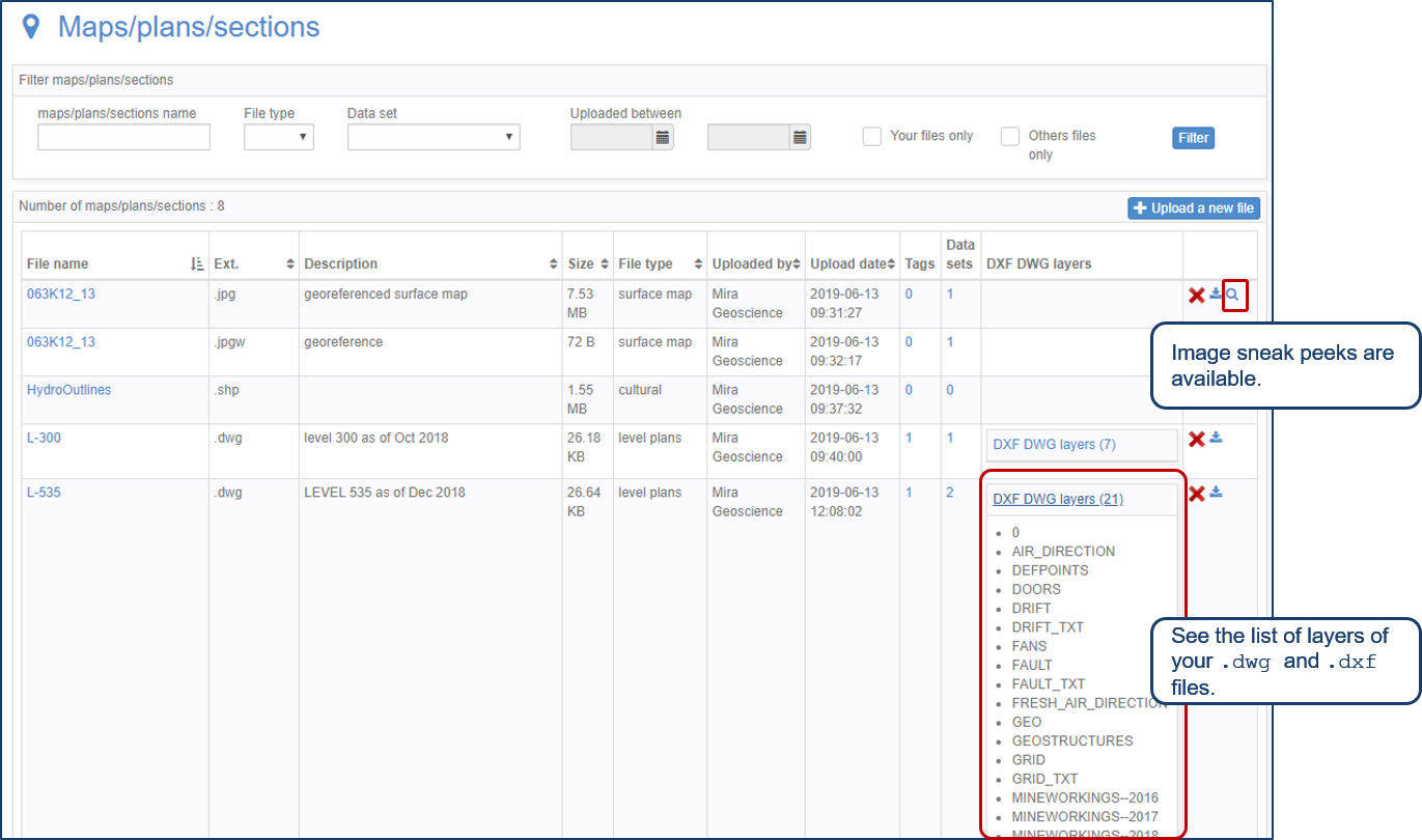
Preview files in the Maps/plans/sections page
See the list of layers of your .dwg and .dxf files. Image sneak peeks are also available...

Easily display a property on multiple objects
In GOCAD Mining Suite objects are grouped by the properties they contain...