


What’s new in software:
VP Geophysics Suite’s VPmg version 9.3, VPem1D version 4.3 and VPutility version 1.2 releases
Released June 2019, this release improves the performance of inverting data with VP products. VPmg now greatly reduces the size of the derivative matrices during heterogeneous inversion. Inactive prisms will only be forward-modelled once, also noticeably increasing the overall speed of large inversions. In this version, polygonal areas can be auto-padded for integration into existing models. VPem1D now takes a single control file and VPutility can now export VP models into .csv files. User-found-fixes were made to improve your modelling and inversion experience.

More information about VP Geophysics Suite available here
Latest news

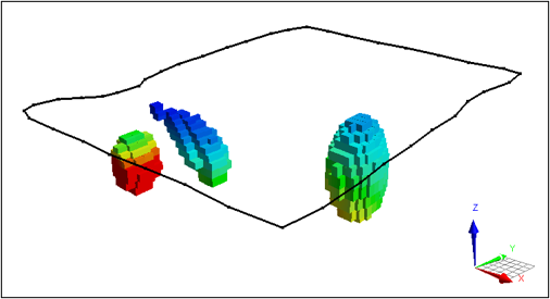
Revolutionizing Subsurface Interpretation and 3D Visualization with Geoscience ANALYST Pro
Discover how EnBW is bridging the gap between 2D mapping, 3D seismic interpretation, and integrated geophysical workflows

Editing property settings: Display template
In GOCAD Mining Suite you can editing property settings through display templates...

No-data values on import templates
In Geoscience INTEGRATOR, you can prevent importing no-data value strings by providing a general NDV to be applied to all properties of the template...

Show and hide
In Geoscience ANALYST you can show and hide everything, individual objects, container groups or drillhole groups...

Finding data sets by tags and neighbourhoods
In Geoscience INTEGRATOR, you can can lookup data sets by the tags they carry and the neighbourhoods they cover...

New importer: 2D SEG-Y
In Geoscience ANALYST you can visualize your block model data by volume in the Visual Parameters panel...
..

Object’s history
In GOCAD Mining Suite, objects keep a history of all the commands you apply to them, this includes...

Cloning import templates
In Geoscience INTEGRATOR, cloning an import template provides a ready-to-edit copy without having to build a new one from scratch...

Effective date field
Geoscience INTEGRATOR v3.7 offers the Effective date upload field for files and maps...

Drillhole Statistics
In Geoscience ANALYST you can compute drillholes’ deviation statistics. These include...

GEOH5 open format
We developed geoh5 based on free and open-source HDF5 technology because of its many advantages: wide acceptance across numerous data-intensive industries...
VPem3D in Geoscience ANALYST Pro Geophysics
Accelerating 3D TEM Interpretation with and without Geological Constraints. Read more >>