


A project is likely to collect a great quantity of files on both the File manager and the Maps/plans/sections pages. On top of using Tags and Data set linking, you can give them a File type from a customizable list in the project settings.

Previous tips can be found under the Software tip category in the News section and in the Archives section of our website.
Latest news

Easily display a property on multiple objects
In GOCAD Mining Suite objects are grouped by the properties they contain...

Drillhole Statistics
In Geoscience ANALYST you can compute drillholes’ deviation statistics. These include...

New release – GOCAD® Mining Suite V14.5
GMS V14.5 expands the Python API, enhances connectivity with Geoscience ANALYST, and improves interoperability through the open GEOH5 format.

Editing property’s colormap
In GOCAD Mining Suite, when you select a property its colormap can be edited...
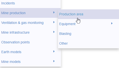
New mine production theme
In Geoscience INTEGRATOR, version 3.2 has a new theme called Production area. It’s designed for stope, mining room, or drawpoint data...

Day interval filters
In Geoscience INTEGRATOR the Day interval filter can be used to search your time-based data for “the last X days”, or...
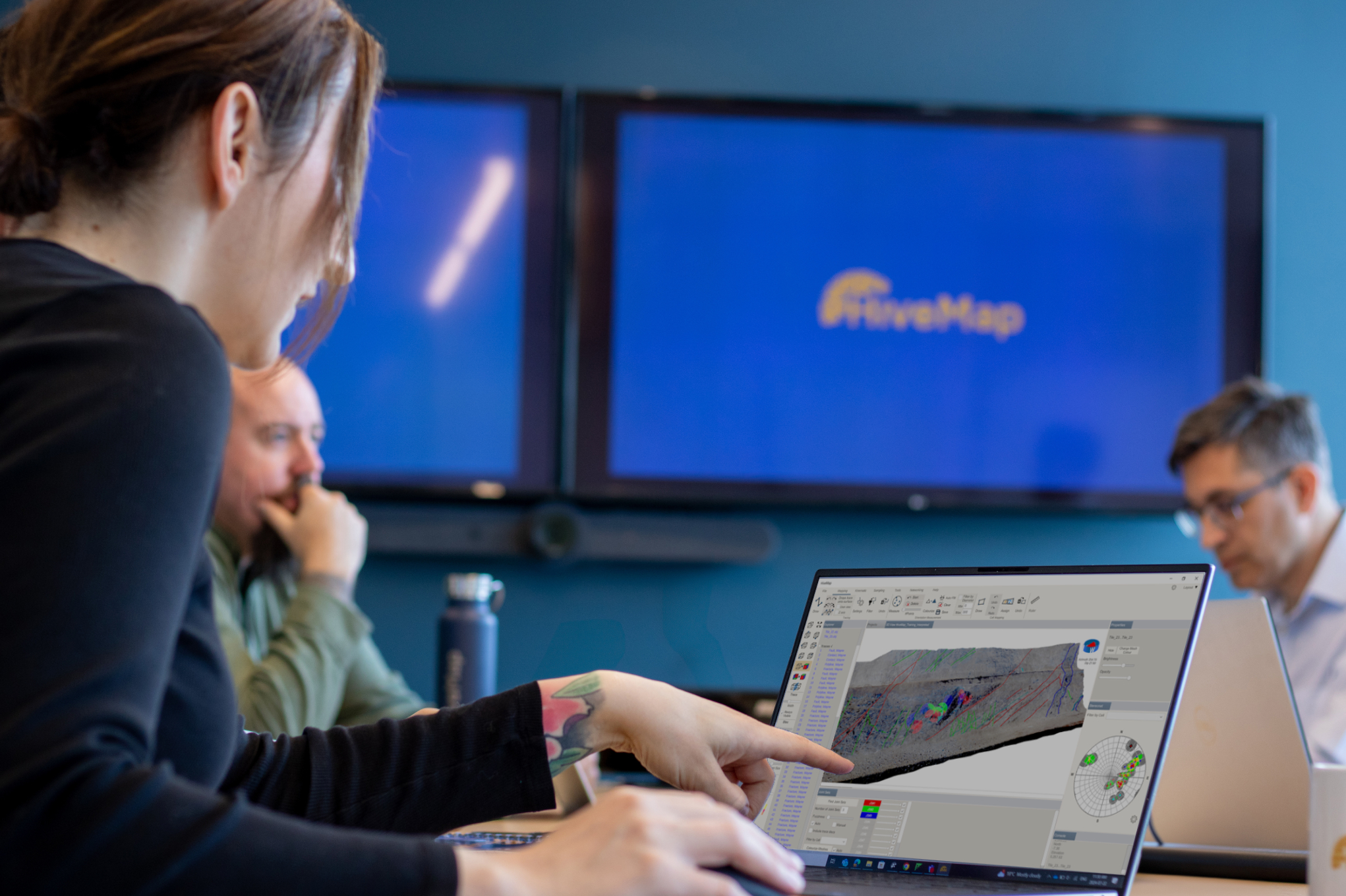
Introducing HiveMap
Capture geological observations quickly, safely, and accurately, both in the field and office with HiveMap...
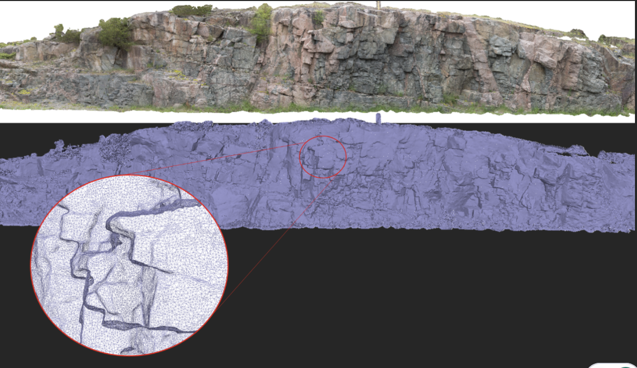
Creating Mappable Surfaces
Capture geological observations quickly, safely, and accurately, both in the field and office with HiveMap...

Default data colour settings
In Geoscience ANALYST you can set a default colour table and colour mapping transformation function. This way, when you import or create new data, it will be coloured by default.

Editing property transparency
In GOCAD Mining Suite, when you select a property its transparency can be edited...
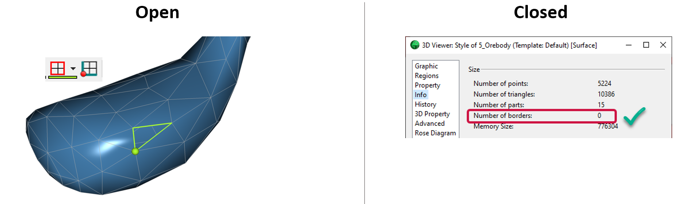
Is the surface opened or closed?
In GOCAD Mining Suite you can easily know if your surface is opened or closed by...

Drape Voxet properties on surfaces
In GOCAD Mining Suite you can texturally drape your images and 2D gridded data onto surfaces, for example...