


You can easily import objects from one GOCAD project to another by going to File > Import > Objects from Project.
- When you select your GOCAD project from your browser, a list of that project’s objects will appear.
- Sort the columns to easily navigate through the list of objects and select which ones you want to import.
- In the Import Options, if you choose to Copy into project selected objects and all linked objects, it will also import linked objects, for example a geology log’s classification or the horizons used to build a model.

Previous tips can be found under the Software tip category in the News section and in the Archives section of our website.
Latest news

Coordinate system transformations
In Geoscience ANALYST Pro version 4.0, you can apply coordinate system transformations to...
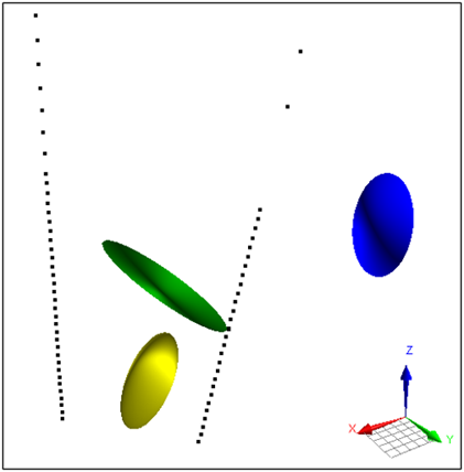
Parametric Ellipsoid Modelling in Geoscience ANALYST Pro Geophysics
We are evolving the way we organize and share our technical content to better support your needs.

Peak finder – Geoscience ANALYST geoapps: Python application
Past event. Link to recording available here.
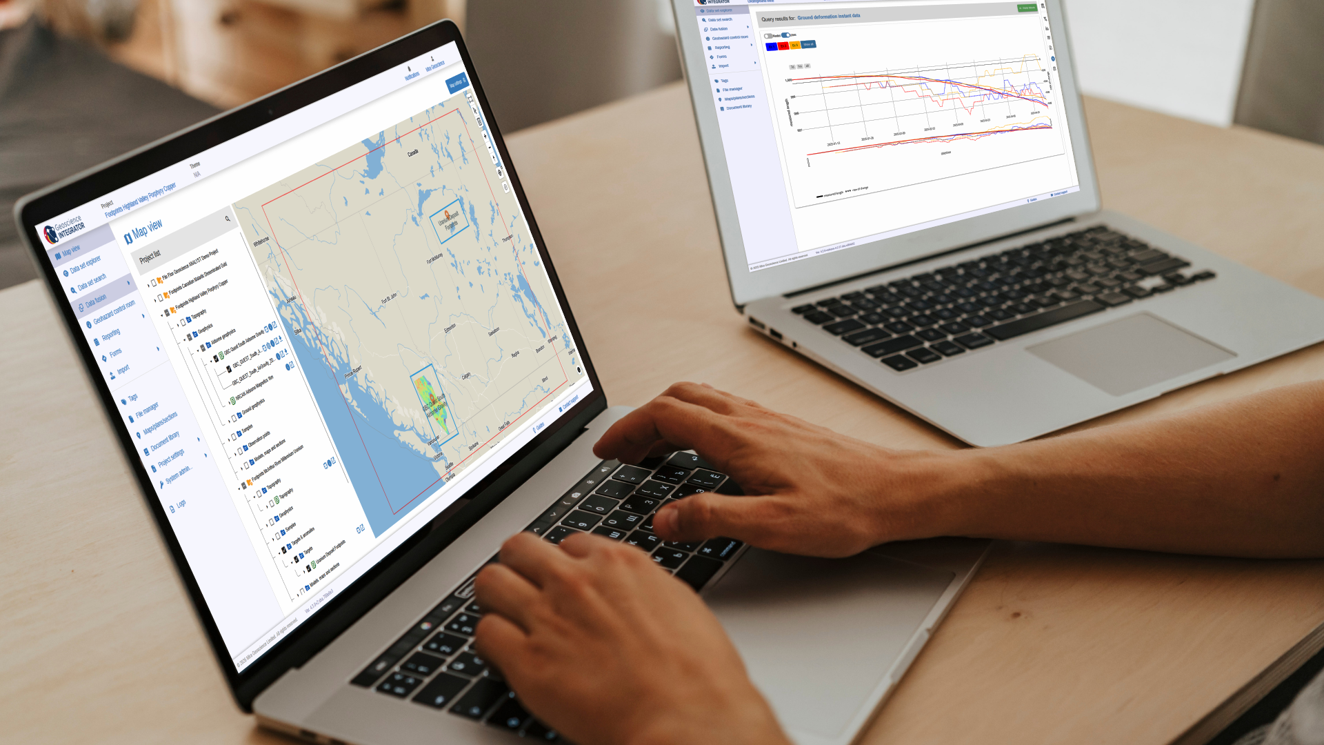
New release – Geoscience INTEGRATOR 4.3
Geoscience INTEGRATOR 4.3 introduces exciting new features to help you manage your data more efficiently and streamline your workflow

Revolutionizing Subsurface Interpretation and 3D Visualization with Geoscience ANALYST Pro
Discover how EnBW is bridging the gap between 2D mapping, 3D seismic interpretation, and integrated geophysical workflows

Generating exploration models from a detailed structural interpretation and Artificial Intelligence
This approach uses the comment field of the logging table to extract general topics that can then be used as learning features in a supervised machine learning classification approach.

Bounding boxes in the viewer
Coloured bounding boxes are used to highlight volumes in the Viewport: A purple box surrounds your current selection...

Uploading multiple files
In Geoscience INTEGRATOR, you can upload multiple files in one simple step...

Deep Learning as an alternative to downward continuation filters for structural interpretation
Jean-Philippe Paiement proposes an alternative approach to the commonly used downward continuation filters used in the industry...

How to run gravity inversions in a geologically driven way
Past event, view here or on our YouTube Channel to see how to run a 3D inversion and forward modelling in Geoscience ANALYST Pro using VPmg...

Using Python with Geoscience ANALYST
A new Geoscience ANALYST Python API, providing the capability of connecting to open source software, is scheduled for release....

Rapid and accurate mapping
We explain how automated generation of alteration maps using radiometric data is well-suited to large-footprint mineral systems...