


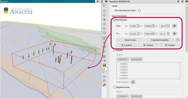
With Geoscience INTEGRATOR v3.6, drillhole sample locations are automatically computed as XYZ by the system from the deviation surveys, making spatial searches more versatile and accurate.
For example, when querying samples by spatial extent through the 3D viewer, it will quickly show you all the drillhole samples located within that bounding box.
Previous tips can be found under the Software tip category in the News section and in the Archives section of our website.
Latest news

Tabular property viewer
In GOCAD Mining Suite you can view your object’s properties in a tabular format with the Tabular Property Viewer...
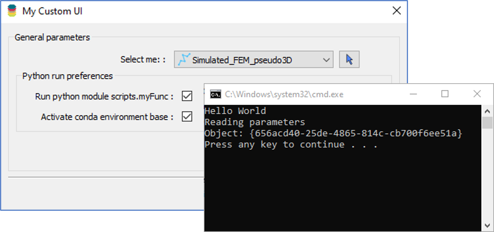
Using Python in Geoscience ANALYST Pro – Virtual Lecture
Past event, link available here...

Bounding boxes in the viewer
Coloured bounding boxes are used to highlight volumes in the Viewport: A purple box surrounds your current selection...

Snapshot grid sections
In GOCAD Mining Suite quickly take snapshots of your Voxet sections using the snapshot tool...
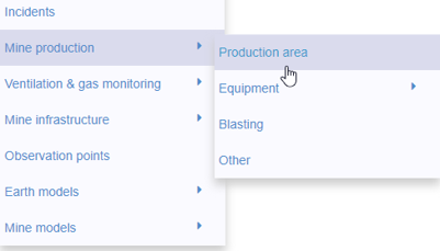
New mine production theme
In Geoscience INTEGRATOR, version 3.2 has a new theme called Production area. It’s designed for stope, mining room, or drawpoint data...

Drillhole data interpretation – Geoscience ANALYST free viewer and Python
Past event, link to the recording is available here...

New raster imports
In Geoscience ANALYST you can now import GeoTIFF (tif, tiff), ERMapper (ers), and Surfer (grd)...
..

Including water bodies in gravity and magnetic inversion modelling – Geoscience ANALYST Pro Geophysics
Thomas Campagne demonstrated how to explicitly include bathymetry in inversion modelling of near-shore gravity data...

Import geoh5 into GOCAD Mining Suite
Seamlessly go between GOCAD Mining Suite and Geoscience ANALYST...

Manual classifications vs Project classifications
In Geoscience INTEGRATOR, There are two ways to create classifications when importing data...

Depth-to-basement inversion using geometry and homogeneous VPmg inversion
Past event - View here or on our YouTube channel...

Getting started with the Python geoh5py
Past event, view here or via our YouTube channel...