


The newest version of Geoscience INTEGRATOR brings exciting new features to help you manage your data more efficiently and streamline your workflow
Key new features:
-
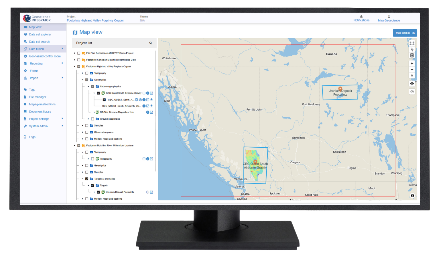
A new interactive 2D map interface for spatial data discovery
-
Data overwrite and replace across all drillhole themes
-
Data upload to Geoscience INTEGRATOR directly from Geoscience ANALYST
-
Email summary of recently imported data for project stakeholders
Is this your first time working with Geoscience INTEGRATOR?
Visit our YouTube channel, or check out the Resources tab on our website for additional information. You can also sign up for our email newsletter or join our community on LinkedIn to stay abreast of the latest news.
Please contact our team for additional information about our products and services
Latest news

Geoscience ANALYST Pro Geophysics Consortium
Focused on delivering software and methods that make the use of advanced geophysics a day-to-day, practical reality for industry.

Using comment field entries in drillhole databases to automatically re-log lithologies
This approach uses the comment field of the logging table to extract general topics that can then be used as learning features in a supervised machine learning classification approach.

Data fusion – Automatic sample compilation
In Geoscience INTEGRATOR, the Sample compilation page offers powerful tools to support the analysis of complex or difficult-to-view relationships within your sample data...

Mira Geoscience receives the 2023 AME Innovation Award
John McGaughey, Mira Geoscience's President, has been selected for the 2023 AME Innovation Award for leading the development of GEOH5.
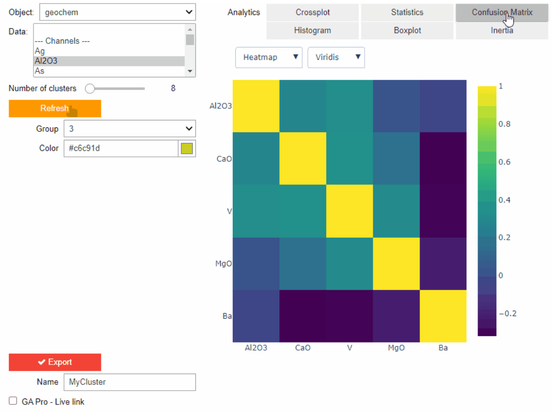
Clustering data stored on geoh5 objects
Past event. View here or on our YouTube channel...

Drillhole Statistics
In Geoscience ANALYST you can compute drillholes’ deviation statistics. These include...


Importing and preparing DC/IP data for inversion with Geoscience ANALYST – Virtual Lecture
In 20 mins, Kristofer shows v3.4 new functionality for pre-processing and visualization of DC/IP 2D and 3D data - Geoscience ANALYST...

DC resistivity inversion in Geoscience ANALYST Pro Geophysics
Past event, view here or via our YouTube channel...

New raster imports
In Geoscience ANALYST you can now import GeoTIFF (tif, tiff), ERMapper (ers), and Surfer (grd)...
..

Scripting
In Geoscience ANALYST Pro the Script on Object Property utility in Geoscience ANALYST Pro can be used in a wide variety of geoscientific applications...

New clustering application in geoapps
geoapps - Exploratory Data Analysis (EDA), rock classification generation, or map alteration footprints