


Geological modelling projects with extensive historical data can be plagued by overly-complex lithological dictionaries and inconsistency in logging. To properly interpret and model the lithologies, geologists often have to reclassify the lithological entries into a new legend by a combination of re-logging, reading comments, and a certain amount of informed guesswork. Coming up with an automated way of reclassifying the lithological entries to a consistent legend that is meaningful for modelling has always been a challenge.
By using Latent Semantic Analysis (LSA), a technique that uses natural language processing in order to analyze relationships between a set of entries and the words they contain to extract a set of more general underlying concepts, Mira Geoscience developed a workflow to re-log drillhole databases into new lithological classes using textual comments. This approach uses the comment field of the logging table to extract general topics that can then be used as learning features in a supervised machine learning classification approach. The features are used in combination with a few re-logged control holes, with the desired lithological target labels, to produce a new set of lithological entries.
”"We are excited to be able to provide an efficient and quick way to re-log drillhole intervals based on existing datasets. This tool is a great example of ‘low-hanging fruit’ in the application of unsupervised and supervised learning to geological data, adding value to legacy databases."
Jean-Philippe PaiementDirector, Global Consulting

General concept behind the LSA re-logging process developed by Mira Geoscience (top). The word-frequency count for the test case data (bottom left) and main 9 topics extracted from the logging comments together with the first 3 most frequent terms in each topic.
Case study: Application of Latent Semantic Analysis and supervised learning
Current re-logging approaches offered on the market have limitations. For example, in automated re-logging using core photos, the consistency of the dataset is crucial, but hard to attain. Pictures are represented as numerical arrays (or matrices) with statistical distributions that can vary depending on the quality of the images. Changes in the lighting, wet or dry core, or adding noise while processing image classifications can drastically impact the predictions.
Mira Geoscience’s approach is to use a combination of unsupervised and supervised learning for model-based re-logging to associate consistent lithological entries to a set of control holes. This novel approach greatly benefits exploration projects with dense historical data by unifying thousands of disparate and inconsistent entries into a new, usable lithological legend. This solution requires a minimum amount of re-logging of control holes and can be combined with geochemical interpretation to increase the model’s accuracy.
The use of LSA stems from the realization that geologists have been trained at identifying rocks using standard criteria such as colour, texture, grain size distribution, or hardness. Those identification criteria are most often logged as comments in the core logging databases. The resulting textual comments are reasonably consistent across time, companies, and projects. This textual field also represents a good opportunity for increasing data quality since it is, most of the time, recorded or easily scanned from paper and processed using Optical Character Recognition (OCR).

The comments are translated into a correlation matrix and topic latent space from which learning features are built to predict the target labels
The idea of the workflow is to use LSA to extract underlaying geological concepts from the logs to give key insights into the geological relationships described in the comments. To simplify the topic distribution visualization, a Network Graph approach is used to display a correlation matrix between the extracted terms. Each topic is represented by a special vector that can then be embedded in a 3D space using ‘UMAP.’ This creates a point cloud with each entry and their associated topics. Once the unsupervised learning phase of the workflow is completed, each logging interval knows its related topic vector space together with its dominate subject assignment. By conducting a targeted re-logging campaign on key drillholes, a new set of labels are generated according to the current modelling needs of the exploration strategy. The labels are used in a supervised learning approach as targets (and testing sets), and the topic vectors are used (with some feature engineering) as learning features. The labels feature combination is used to build a predictive model of the desired lithological entries. The model is then used to predict new labels that are then predicted across the drilling database. Predicted interval labels along with products from the unsupervised learning process can now be imported into 3D modelling software such as GOCAD Mining Suite or Geoscience ANALYST to serve as a base for geological interpretation and modelling.

Initial lithological intervals (top) with re-logged entries (bottom)
Artificial intelligence at Mira Geoscience:
At Mira Geoscience, we are dedicated towards developing efficient customized solutions to geological problems using different machine learning approaches. Since not all problems are equal, solutions must be customized for efficiency. A great emphasis is put on the geoscientific development and understanding of the datasets prior to the application of machine learning techniques. We offer the right combination of geoscientists and data scientist to solve targeted problems and hep move exploration forward.

Jean-Philippe Paiement – Director, Global Consulting
Jean-Philippe is our Director of Global Consulting. He brings 10 years of mineral exploration experience including expertise in geostatistics, structural, geological, and geochemical modelling and interpretation. He is skilled in the application of machine learning to overcome geological challenges and with new methods to reduce interpretational risks with geological data. He has a wide range of experience in mineral resource estimation for precious metals, base metals and industrial minerals across diverse geological environments around the world. He obtained an MSc from Laval University. Jean-Philippe is based in Quebec-City.

Shaun O’Connor – Geologist
Shaun is an exploration geologist with 10 years of experience in exploration and mineral systems modelling for gold, base metals, lithium, and industrial minerals in varied geological environments, including Cordilleran arcs and intrusions, Archean greenstone belts, and bimodal volcanic systems. Before joining us, Shaun leveraged his strong geological field experience, software expertise, and talent for modelling and research to help unlock the value of geological data and revolutionize exploration frameworks for clients ranging from independent prospectors to top gold producers worldwide. Shaun obtained his MSc in geological sciences from Queen’s University and is based in Halifax, Canada.
Latest news

GEOH5 open format

3D seismic data

Visualize 3D vector properties

Mira Geoscience receives the 2023 AME Innovation Award
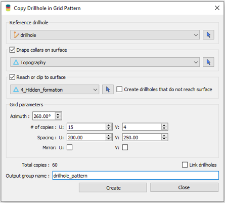
Copying drillholes in a grid pattern

Importing and visualizing VP Geophysics models

The value of using structural restoration tools in exploration modelling – Virtual Lecture

Roles and permissions

Managing import templates

John McGaughey receives the Grahame Sands Award

Including water bodies in gravity and magnetic inversion modelling – Geoscience ANALYST Pro Geophysics
