



Creating Digital Models of Rock Exposure for Geological and Geotechnical Mapping
The launch of HiveMap has allowed geoscience professionals to create visual representations of rock exposure from both above and below-surface environments. The datasets may be acquired through a variety of terrestrial and drone-based remote sensing methods, including photogrammetry and LiDAR solutions. Technology as simple as the iPhone in your pocket is able to collect the required LiDAR dataset to facilitate mapping with HiveMap.
Let’s take a closer look at each of these methods and their benefits and limitations.
Photogrammetry for Geotechnical Mapping
Terrestrial Photogrammetry
By using a high-resolution DSLR or cell phone camera, one can capture images of rock faces to create detailed 3D models. This occurs by capturing multiple overlapping photos of the rock face at different angles and processing them using photogrammetry software to create 3D mesh and imagery files. This method has been found suitable for mapping small outcrops and bench faces, especially in areas where drone access is limited or restricted. The benefits of terrestrial photogrammetry are that it is cost-effective, versatile, and can be used in various environments, including open pits and underground headings, with a sufficient lighting setup.
Drone Photogrammetry
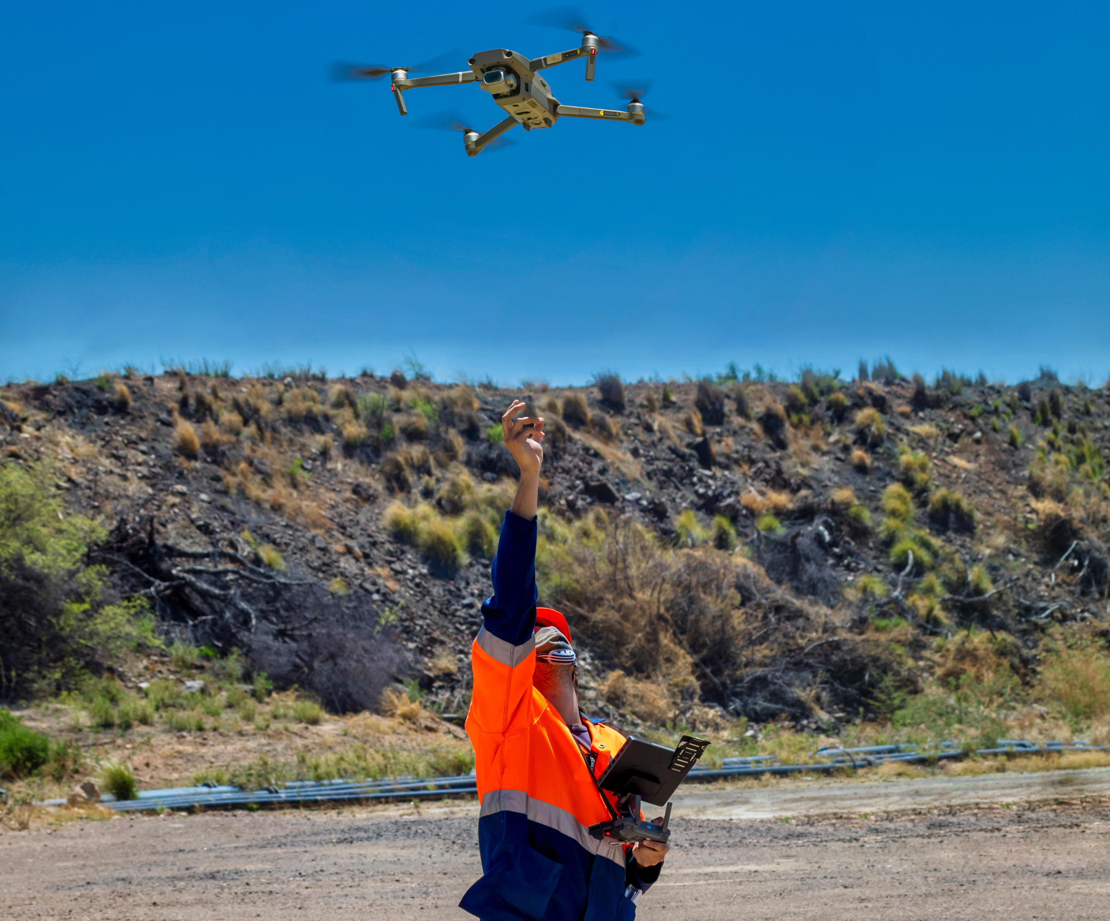
Drone photogrammetry uses unmanned aerial vehicles (UAVs) equipped with high-resolution cameras to capture aerial images of rock exposure, a method which is ideal for covering large areas quickly and efficiently. Drones are programmed to fly over the target area, capturing overlapping images from multiple angles. The captured images are processed to create a textured 3D mesh file. Photogrammetry software also stitches the images together to form a high-resolution image overlay for the 3D mesh.
This is the ideal method for large-scale surveys in open-pit mines and exploration projects, allowing for rapid geotechnical mapping data collection, the creation of high-resolution imagery, and the ability to access difficult locations. Drones can cover extensive areas in a short amount of time, making them highly efficient for large-scale applications.
3D Spatial Data Collection Using LiDAR Scanning
Terrestrial LiDAR Scanning
The introduction of LiDAR (Light Detection and Ranging) technology in consumer devices like the iPhone and iPad has made 3D spatial data collection more accessible than ever. LiDAR sensors work to emit laser pulses and measure the time it takes for them to return, creating accurate 3D models of rock faces. The benefit of this technology is that it populates the data in real-time. Minimal training is needed to use LiDAR software, and it’s easily portable, which isn’t always the case for terrestrial photogrammetry methods. A constraint of LiDAR technology is that the sensor is limited to a range of 5 meters, and the resolution is low. However, with LiDAR technology, an iPhone or iPad user can map small outcrops, bench faces, and confined underground environments.
LiDAR devices (which are not specific to iPhone or iPad devices) use laser pulses to generate point clouds, which can be converted into detailed surface meshes. The benefit of this software is its high accuracy and versatility, making it suitable for both surface and underground mapping. These LiDAR devices work in the same way as above, bouncing their laser pulses off surfaces and measuring the time it takes to return, creating a point cloud that represents the 3D structure of the rock face. This point cloud can then be processed to generate a 3D mesh file.
Drone Photogrammetry
Drone photogrammetry uses unmanned aerial vehicles (UAVs) equipped with high-resolution cameras to capture aerial images of rock exposure, a method which is ideal for covering large areas quickly and efficiently. Drones are programmed to fly over the target area, capturing overlapping images from multiple angles. The captured images are processed to create a textured 3D mesh file. Photogrammetry software also stitches the images together to form a high-resolution image overlay for the 3D mesh.
This is the ideal method for large-scale surveys in open-pit mines and exploration projects, allowing for rapid geotechnical mapping data collection, the creation of high-resolution imagery, and the ability to access difficult locations. Drones can cover extensive areas in a short amount of time, making them highly efficient for large-scale applications.
Data Collection Practices
Open Pit Environments
Drone photogrammetry is a powerful tool for capturing high-resolution, accurate 3D models of open pit mines. Specialized software is used to plan the flight path, ensuring adequate overlap between images, typically 70-80% front and side overlap. It’s important to note that flight time should be selected when there are no shadows covering the rock faces in the area of interest and that the drone’s camera should face the bench faces. This is ideally achieved during overcast weather conditions.
Ground Control Points (GCPs) are placed throughout the survey area to improve the accuracy of the photogrammetric model. These GCPs should be clearly visible in the images, and their coordinates should be measured accurately using GPS. Using an RTK GPS-equipped drone will improve the accuracy of the georeferencing.
For smaller areas, such as small outcrops or bench faces, iPhone and iPad scanning or terrestrial photogrammetry can be utilized. LiDAR-equipped iPhones and iPads are easy to use, capturing detailed spatial data in real-time, which allows users to review the captured data in the field. Two survey points are needed for georeferencing because iPhone/iPad scans have the correct horizontal axis and scale. However, photogrammetry is a better option if the rock face is more than 5 meters away or if a higher resolution is required. At least four survey points are needed for georeferencing the model.
Additionally, laser scanners, whether terrestrial or drone-mounted, can be used to obtain the point cloud of the surfaces, which can be converted into surface meshes for geological mapping.
Drone Photogrammetry
Drone photogrammetry uses unmanned aerial vehicles (UAVs) equipped with high-resolution cameras to capture aerial images of rock exposure, a method which is ideal for covering large areas quickly and efficiently. Drones are programmed to fly over the target area, capturing overlapping images from multiple angles. The captured images are processed to create a textured 3D mesh file. Photogrammetry software also stitches the images together to form a high-resolution image overlay for the 3D mesh.
This is the ideal method for large-scale surveys in open-pit mines and exploration projects, allowing for rapid geotechnical mapping data collection, the creation of high-resolution imagery, and the ability to access difficult locations. Drones can cover extensive areas in a short amount of time, making them highly efficient for large-scale applications.
Underground Environments
In underground environments, iPhone/iPad scanning or terrestrial photogrammetry can be used to capture detailed 3D models of rock faces, however, sufficient illumination is essential for these methods to work effectively underground. For georeferencing, two survey points for iPhone/iPad scanning and four points for photogrammetry are sufficient.
Additionally, handheld, tripod or drone-mounted laser scanners can be used to scan the rock faces. Even in low-light conditions, LiDAR devices can generate point clouds. These point clouds will not have colour information but will have intensity values for mesh colouring. Drones with laser scanners can access locations that are not accessible to people such as stopes.
HiveMap: Revolutionizing Geological Mapping with Advanced Technology
HiveMap’s 3D mapping software, can intake and visualize the previously discussed photogrammetry and LiDAR datasets. This provides geoscience professionals with a more efficient way to create geological interpretations from these high-resolution data sources. Such interpretations can be readily used in downstream modelling software to improve the reliability and availability of data used to inform geological models.
Please contact our team for additional information about our products and services
Latest news

GEOH5: A Framework for Geoscience Data and Model Portability

Mira Geoscience receives the 2023 AME Innovation Award

New release – Geoscience ANALYST 4.6

Machine learning in mineral exploration

Geological 3D-GIS query

Object’s Info

Deep Learning as an alternative to downward continuation filters for structural interpretation

Arbitrary sections

New release – Geoscience INTEGRATOR 3.9

Using ioGAS in Geoscience ANALYST Pro – Virtual Lecture

