



Now with Geoscience ANALYST 4.0 you can georeference your geology maps and cross sections with Geoscience ANALYST Pro by right-clicking on your Geoimage > Georeference to Landmarks.

Display multiple Viewports (Panels > Add Viewport) to make the georeferencing easier and faster!
Take a look at this video for a georeferencing demo.
Previous Geoscience ANALYST tips can be found under the Software tip category in our Resources page and in our Archives page.
Latest news

Coordinate display area
In Geoscience ANALYST you can get real-time feedback on the XYZ coordinates corresponding to the...
..

Viewing data from report items
In Geoscience INTEGRATOR table and chart items from ad-hoc or scheduled reports can be easily refreshed, using the same filters that were applied in the original report, to display current data.

Data set summaries
In Geoscience INTEGRATOR The Data set explorer provides simple, immediate ‘dashboard’ access to all the data sets, and their summary information...

Organizing files as data sets
In Geoscience INTEGRATOR, a data set is often composed of a group of files of various formats along with metadata. These can be grouped...

Let the data speak!
Four years ago, along with DMT Group, we started working with JSC Apatit on their Kirovski and Rasvumchorr mines that...

Custom discrete colour scales
Geoscience INTEGRATOR allows you to build and display custom colour scales when making a scatter plot or...

Default data colour settings
In Geoscience ANALYST you can set a default colour table and colour mapping transformation function. This way, when you import or create new data, it will be coloured by default.

Rapid and accurate mapping
We explain how automated generation of alteration maps using radiometric data is well-suited to large-footprint mineral systems...

Data fusion – Automatic sample compilation
In Geoscience INTEGRATOR, the Sample compilation page offers powerful tools to support the analysis of complex or difficult-to-view relationships within your sample data...


Filtering samples by their drillhole
In Geoscience INTEGRATOR, you can can filter them according to the drillhole they are located in...
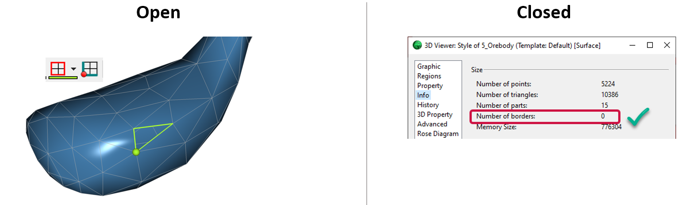
Is the surface opened or closed?
In GOCAD Mining Suite you can easily know if your surface is opened or closed by...