


When you select a property, its colormap should appear in the Secondary Style toolbar. You can also access it by opening that property’s Style Editor.
Using the pencil, draw on the colormap to edit the property’s transparency. ![]()

You can also use the following tips:
- Hold down the ALT key to keep a constant transparency.

- To create a binary (0% or 100%) transparency, use the CTRL key.

- To reset the transparency settings to none, click the middle mouse button.
Previous tips can be found under the Software tip category in the News section and in the Archives section of our website.
Latest news

UDMN Award of Excellence
Geoscience INTEGRATOR wins - Last December, UDMN presented us with an Outstanding Achievement in Commercialization...

Object’s Info
In GOCAD Mining Suite you can see how many nodes or triangles your Surface object consists of by right-clicking on...
Building a greenfields project from public data in Geoscience ANALYST Pro – Virtual Lecture
See recording - Gem shows how Geoscience ANALYTS is a great tool to do exploration without getting your boots dirty...

Georeference images
In Geoscience ANALYST Pro you can georeference your geology maps and cross sections with...

New filter options on the File manager and the Maps/plans/sections
In Geoscience INTEGRATOR, you can now find files quickly by using the new extension, tags and uploaded by filters...


Drape Voxet properties on surfaces
In GOCAD Mining Suite you can texturally drape your images and 2D gridded data onto surfaces, for example...

Transfer data between objects
In Geoscience ANALYST Pro you can Transfer data between objects...

Let the data speak!
Four years ago, along with DMT Group, we started working with JSC Apatit on their Kirovski and Rasvumchorr mines that...
Digital Mapping, The Future!
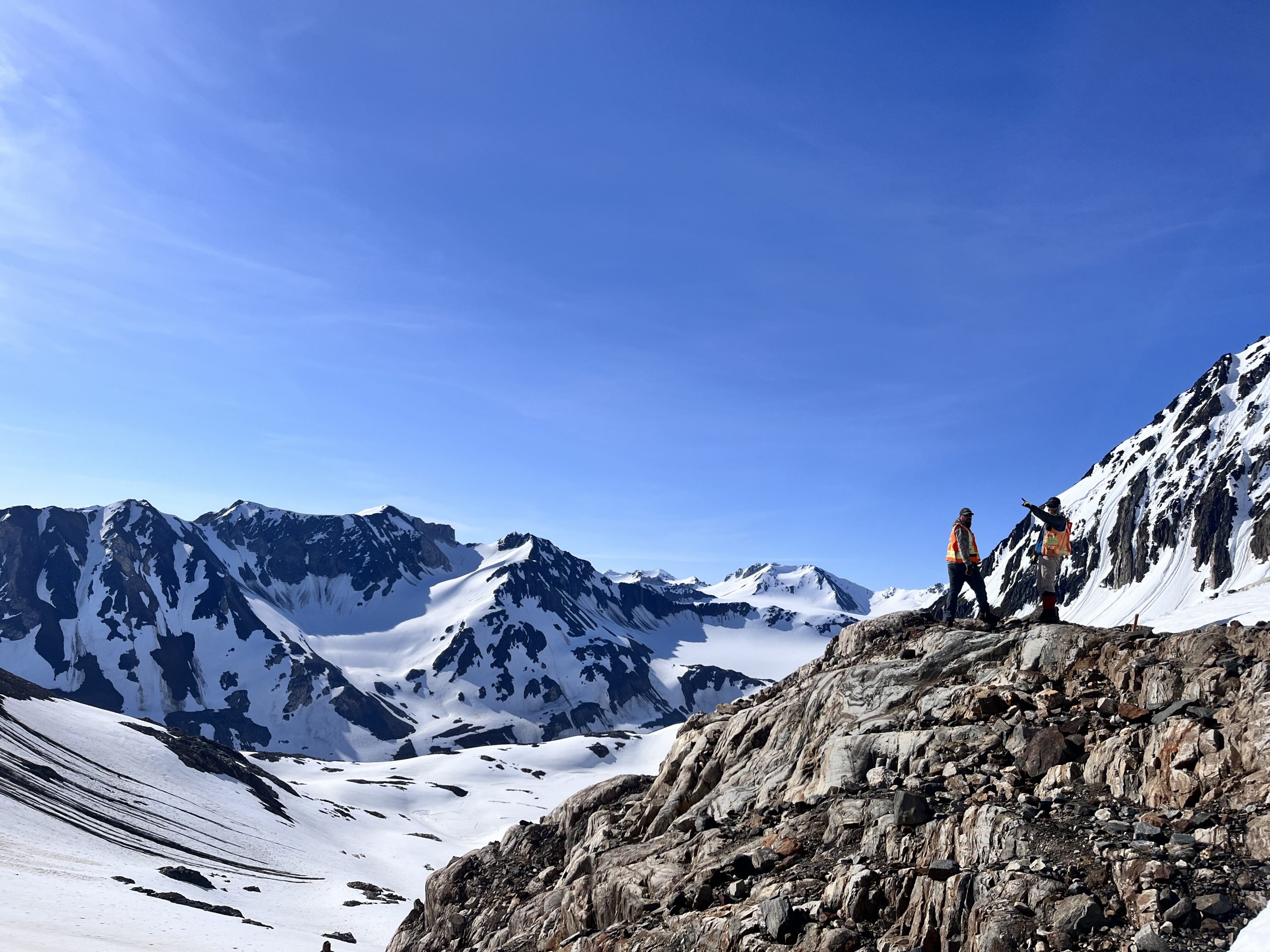
Capture geological observations quickly, safely, and accurately, both in the field and office with HiveMap...

New release – Geoscience INTEGRATOR 4.2
Geoscience INTEGRATOR 4.2 unveils a range of new features and improvements designed to boost performance and enhance user experience.
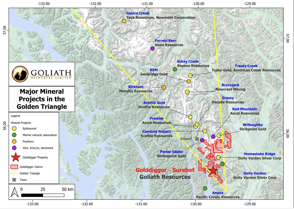
Remote Structural Mapping: A case study from the Golddigger property, BC
Capture geological observations quickly, safely, and accurately, both in the field and office with HiveMap...