


Coffee break… and learn!
Available on our YouTube channel
Thomas Campagne demonstrated how to explicitly include bathymetry in inversion modelling of near-shore gravity data over St George’s Bay, NL. Difficulties in explicitly accounting for the volume of water through the inversion process is a common challenge directly affecting modelling outcomes. Geoscience ANALYST Pro Geophysics and the VPmg inversion software offer a way forward with flexible model creation and inversion capabilities. This lecture showed how to:
- Build a model that explicitly incorporates the volume of seawater
- Assess the gravity response of the seawater
- Perform a 3D inversion of airborne gravity gradiometry data within the bedrock
To get the link to join any of our online event, follow us on LinkedIn or sign up to the mailing list.
Episodes are available on our YouTube channel. More details about this series can be found on our Events page or join the mailing list.
Thomas’s expertise is in geophysical interpretation for mineral explorartion. His career initially focused on supervising and conducting ground geophysical surveys including IP, TDEM, and magnetics. His systematic approach to geophysical data processing and interpretation has evolved into 3D geologically-constrained geophysical inversion and integrated geological interpretation. Thomas obtained his MSc in Geophysics from l’École et Observatoire des Sciences de la Terre Strasbourg, France. Thomas is based in Vancouver.
Latest events and news

Easily display a property on multiple objects

Attending PDAC 2026?
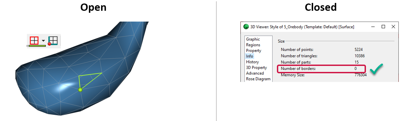
Is the surface opened or closed?

Sneak peek v19
VPem3D in Geoscience ANALYST Pro Geophysics

3D seismic data and survey designer tools

Filter records with, or without files associated to them

Viewing data from report items

Default data colour settings

Using comment field entries in drillhole databases to automatically re-log lithologies

Tabular property viewer
