


Through the Data set search web browser page you can search by data set name or description. Through the viewer, you can search for data sets by defining a 3D search volume, metadata, name, or description.

Previous tips can be found under the Software tip category in our News section and in our Archives section.
Latest news

Taskbar icons
In GOCAD Mining Suite, icons are added to the taskbar when you open windows such as another 3D Viewer or the 3D-GIS Query panel...

Property value range
In Geoscience INTEGRATOR, You can refer to the range of values in the query panel to apply numeric property filters...

Coordinate display area
In Geoscience ANALYST you can get real-time feedback on the XYZ coordinates corresponding to the...
..

Deep Learning as an alternative to downward continuation filters for structural interpretation
Jean-Philippe Paiement proposes an alternative approach to the commonly used downward continuation filters used in the industry...

Revolutionizing Subsurface Interpretation and 3D Visualization with Geoscience ANALYST Pro
Discover how EnBW is bridging the gap between 2D mapping, 3D seismic interpretation, and integrated geophysical workflows

Using magnetic susceptibility measurements to define mineral exploration targets
Combining magnetic survey data with measured drillcore susceptibility data greatly increases the resolution and geometrical accuracy of the magnetic inversion...

Bounding boxes in the viewer
Coloured bounding boxes are used to highlight volumes in the Viewport: A purple box surrounds your current selection...

Python applications for geoscientific problems
geoh5py and geoapps - Open format, open source code, and open licensed data! Cannot get any better than that!

Rock reclassification editor
In GOCAD Mining Suite, you can simplify logging codes for modelling projects and data management using the Rock reclassification editor...

Improved scatter plots
In Geoscience INTEGRATOR, you can can increase/decrease the node size, take snapshots, zoom in on an area of interest...

Q&A with VR Resources
Join us in this exciting conversation with Michael Gunning on how to find success in blue-sky exploration through integrated interpretation of magnetic data and structural geology
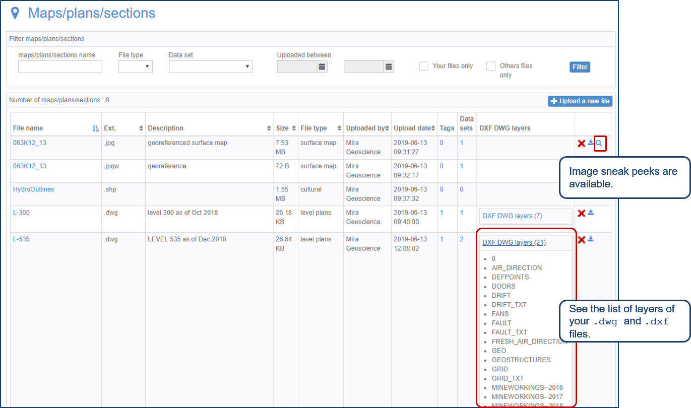
Preview files in the Maps/plans/sections page
See the list of layers of your .dwg and .dxf files. Image sneak peeks are also available...