



Did you make a typo when naming multiple objects, properties, and regions?
Or maybe you changed your mind and would like to change their naming convention?
Through the Search for Objects  menu, access the Find and Replace tool. It will find all occurrences in your objects, properties, or regions that match the search criteria. You can then choose which to replace, or replace all, by the text you specified.

Previous tips can be found under the Software tip category in the News section and in the Archives section of our website.
Latest news

Quick selection search tool
In Geoscience INTEGRATOR we added a search box to help you find objects lists such as drillholes, samples, or stations that often have thousands of items...

Arbitrary sections
In Geoscience ANALYST visualize your block model in any direction with the new arbitrary section

Reopening selected commands
In GOCAD Mining Suite the Log and Command Messages panel has a new tool to reopen previously executed commands...

New importer: 2D SEG-Y
In Geoscience ANALYST you can visualize your block model data by volume in the Visual Parameters panel...
..

Copying objects between Workspaces
In Geoscience ANALYST objects can be copied from one Workspace to another by using Ctrl+C and Ctrl+V...

Editing property’s colormap
In GOCAD Mining Suite, when you select a property its colormap can be edited...

K-means clustering
In Geoscience ANALYST Pro’s v3.3, you can quickly partition your data based on the K-means clustering...

ODBC drillhole import
In Geoscience ANALYST you can import drillholes straight from your ODBC database...
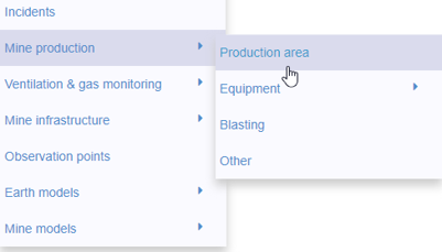
New mine production theme
In Geoscience INTEGRATOR, version 3.2 has a new theme called Production area. It’s designed for stope, mining room, or drawpoint data...

GOCAD Mining Suite – A geological modelling powerhouse
Past event, recording link available here...

How to run gravity inversions in a geologically driven way
Past event, view here or on our YouTube Channel to see how to run a 3D inversion and forward modelling in Geoscience ANALYST Pro using VPmg...

GEOH5: A Framework for Geoscience Data and Model Portability
Used by thousands, GEOH5 is the open-source data structure that is taking down the interoperability barriers and revolutionizing...