


Did you know that objects keep a history of all the commands you apply to them? This includes the commands you used to create them, edit them, and any scripts or computations on their properties.

Double-clicking on a command reports more details on it and allows you to execute it again using the Replay command option ![]() .
.
Previous GOCAD Mining Suite tips can be found under the Software tip category in the Resources section and in the Archives section of our website.
Latest news

Property value range
In Geoscience INTEGRATOR, You can refer to the range of values in the query panel to apply numeric property filters...

Data display precision
In Geoscience ANALYST Data Colours panel you can control the precision of the data...

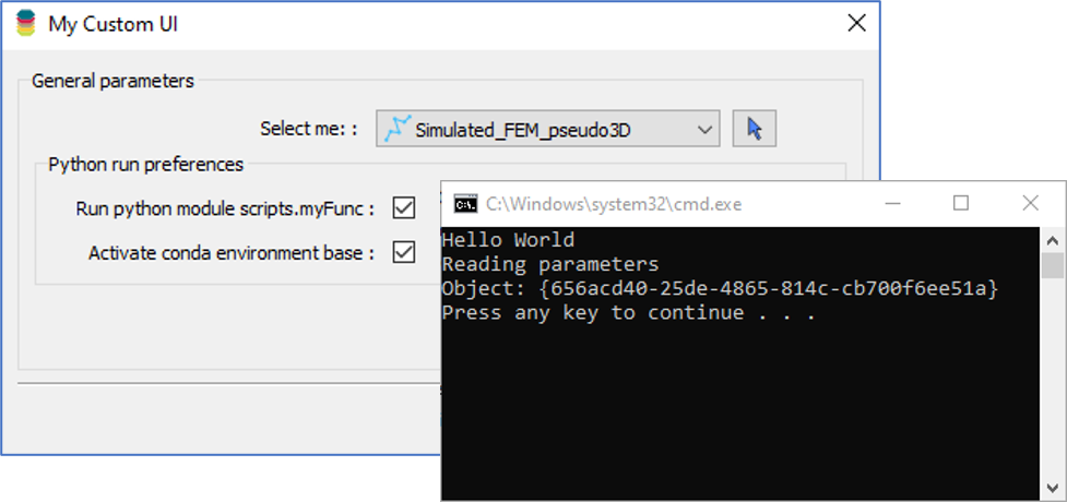
Using Python with Geoscience ANALYST
A new Geoscience ANALYST Python API, providing the capability of connecting to open source software, is scheduled for release....

Upload global descriptions
In Geoscience INTEGRATOR, add an editable global description during import to save time and reduce errors...

Transfer data between objects
In Geoscience ANALYST Pro you can Transfer data between objects...

Sneak peek v19
Emerson-Paradigm released a short video to help users become acquainted with the redesigned interface. Watch this short video ...
Using Python in Geoscience ANALYST Pro – Virtual Lecture
Past event, link available here...

New release – GOCAD® Mining Suite V14.5
GMS V14.5 expands the Python API, enhances connectivity with Geoscience ANALYST, and improves interoperability through the open GEOH5 format.

Meet Polyanna Rowe, PhD
This release includes enhancements to several existing importers and exporters for extended interoperability, and more...

Search for data by spatial extent
This video shows you how to search for data from Geoscience INTEGRATOR by spatial extent...

Finding data sets by tags and neighbourhoods
In Geoscience INTEGRATOR, you can can lookup data sets by the tags they carry and the neighbourhoods they cover...
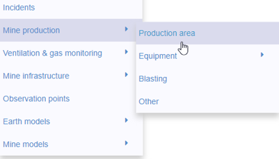
New mine production theme
In Geoscience INTEGRATOR, version 3.2 has a new theme called Production area. It’s designed for stope, mining room, or drawpoint data...