



This video will show you how to search and import data from Geoscience INTEGRATOR data management system using the bounding box feature in Geoscience ANALYST. It is not a step-by-step “how to” per se but shows what can be achieved in a fluid overview. More details on how to take full advantage of this search option is available in the User guide.
Previous tips can be found under the Software tip category in the News section and in the Archives section of our website.
Latest news

HiveMap Digital Mapping Software
Safety is always the number one priority on every job and work site. Whether in underground, open pit, or civil engineering settings, our most important job is to make sure…

Show and hide
In Geoscience ANALYST you can show and hide everything, individual objects, container groups or drillhole groups...
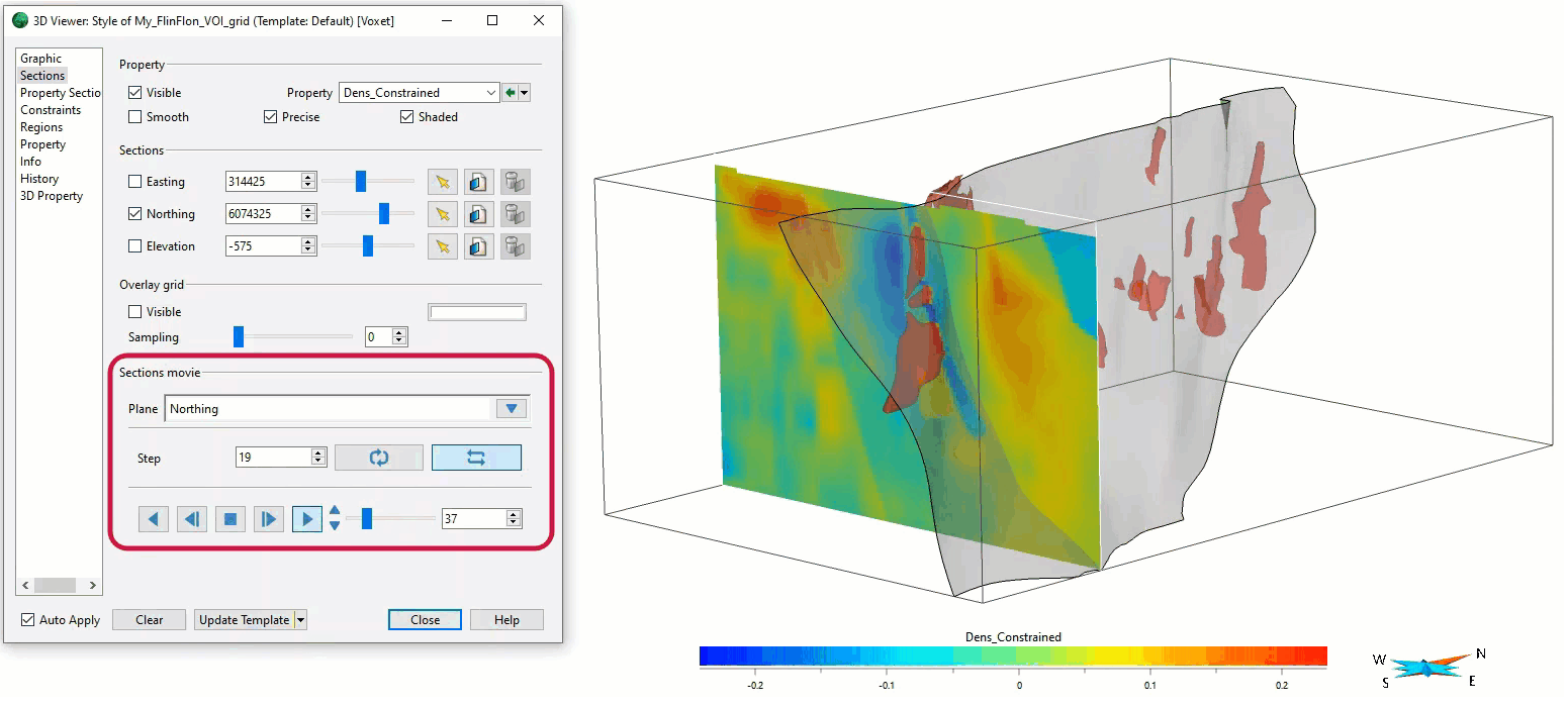
Sections movies
In GOCAD Mining Suite, you can create a section animation by specifying which section plane you want to visualize...

Managing import templates
In Geoscience INTEGRATOR it is possible to edit Import template names and no-data values, activate/deactivate templates, see...

Geological 3D-GIS query
In GOCAD Mining Suite, you can create points at specific geological contacts for the construction of your geological contact surface...

Improved scatter plots
In Geoscience INTEGRATOR, you can can increase/decrease the node size, take snapshots, zoom in on an area of interest...

Search for Objects – find anything, anywhere, anytime
In GOCAD Mining Suite find any objects you're looking for in no time...

R&D project with UDMN
We have been awarded a major R&D project from the Ultra Deep Mining Network (UDMN) called “4D Real-Time Geotechnical Hazard Assessment and Reporting”.

Using ioGAS in Geoscience ANALYST Pro – Virtual Lecture
Past event, recording available here...

Québec Mining 2024
Explore the full interview that Scott Napier did for Québec Mining 2024

Display multiple Voxet sections
In GOCAD Mining Suite, you can create additional sections, hide/show them, use the slider and arrow to position them along the Voxet, and delete them...

Drillhole data interpretation – Geoscience ANALYST free viewer and Python
Past event, link to the recording is available here...