


Coffee break… and learn!
Available on our YouTube channel
Learn about the new and updated drillhole design and monitoring tools in Geoscience ANALYST 4.0. In 15 minutes, Jennifer Levett showed:
- Design drillholes
- Collar to target
- Target to topography
- Collar to targeted surface
- Plan wedges
- Drillhole path analysis and statistics
- Defined monitoring views
- Drillhole path updates to monitor drillhole progression

Jennifer is a Senior Consultant who oversees our GOCAD Mining Suite and Geoscience ANALYST software training and technical support. A geophysicist by background, she has 20+ years’ experience constructing 3D multi-disciplinary geological models in a wide variety of mineral exploration and mining applications. Prior to Mira Geoscience, Jennifer worked in mineral exploration for major mining companies in Australia and Canada, as well in near-mine geophysical exploration in Papua New Guinea. She obtained a BSc Honours in Geology and Geophysics at the University of Sydney. Jennifer is based in Montreal.
Latest events and news

Editing property’s colormap

New raster imports

25 years modelling the earth together

15 tips in 15 minutes

Scripting

Q&A with Oleg Brovko, Senior Project Geophysicist at Geofocus

Easily display a property on multiple objects
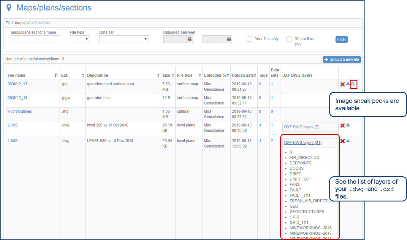
Preview files in the Maps/plans/sections page

UDMN Award of Excellence

Documents linked to a project

What’s new in Geoscience ANALYST version 4.0 – Virtual Lecture
