



Coffee break… and learn about Geoscience INTEGRATOR, Geoscience ANALYST & Python!
Available on our YouTube channel
In this lecture, Jean-Philippe Paiement will show how to import data to Geoscience ANALYST and use it to conduct meaningful Exploratory Data Analysis (EDA), automatically generating geochemical lithological classifications.
In 15 minutes learn how to:
- Import open-licenced lithogeochemical data from a Geoscience INTEGRATOR server
- Quickly assess data quality
- Conduct data normalization
- Cluster data on point support and infer lithologies
- View results in Geoscience ANALYST and compare to other geoscientific data for your project
- Import geophysical data and generate 2D grid
- Data interpolation and clustering
This episode, along with the geoapps, and Free Viewer, is available on demand. More details about this series can be found on our Events page or join the mailing list.

Jean-Philippe is our Director of Global Consulting. He brings 10 years of mineral exploration experience including expertise in geostatistics, structural, geological, and geochemical modelling and interpretation. He is skilled in the application of machine learning to overcome geological challenges and with new methods to reduce interpretational risks with geological data. He has a wide range of experience in mineral resource estimation for precious metals, base metals and industrial minerals across diverse geological environments around the world. He obtained an MSc from Laval University. Jean-Philippe is based in Quebec-City.
Latest events and news

Filter records with, or without files associated to them

Free mineral exploration data through Geoscience ANALYST

Monitoring folders

Generating exploration models from a detailed structural interpretation and Artificial Intelligence
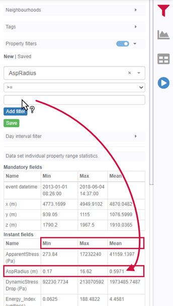
Property value range

Georeference images

Improved scatter plots

Using Python with Geoscience ANALYST

Custom discrete colour scales

Editing property settings: Display template

Drillhole Statistics
