


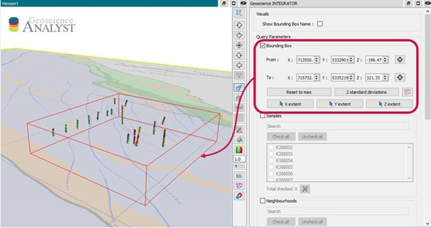
With Geoscience INTEGRATOR v3.6, drillhole sample locations are automatically computed as XYZ by the system from the deviation surveys, making spatial searches more versatile and accurate.
For example, when querying samples by spatial extent through the 3D viewer, it will quickly show you all the drillhole samples located within that bounding box.
Previous tips can be found under the Software tip category in the News section and in the Archives section of our website.
Latest news

Machine learning in mineral exploration
We have applied machine learning as part of custom solutions to complex exploration and geotechnical problems since 2015...
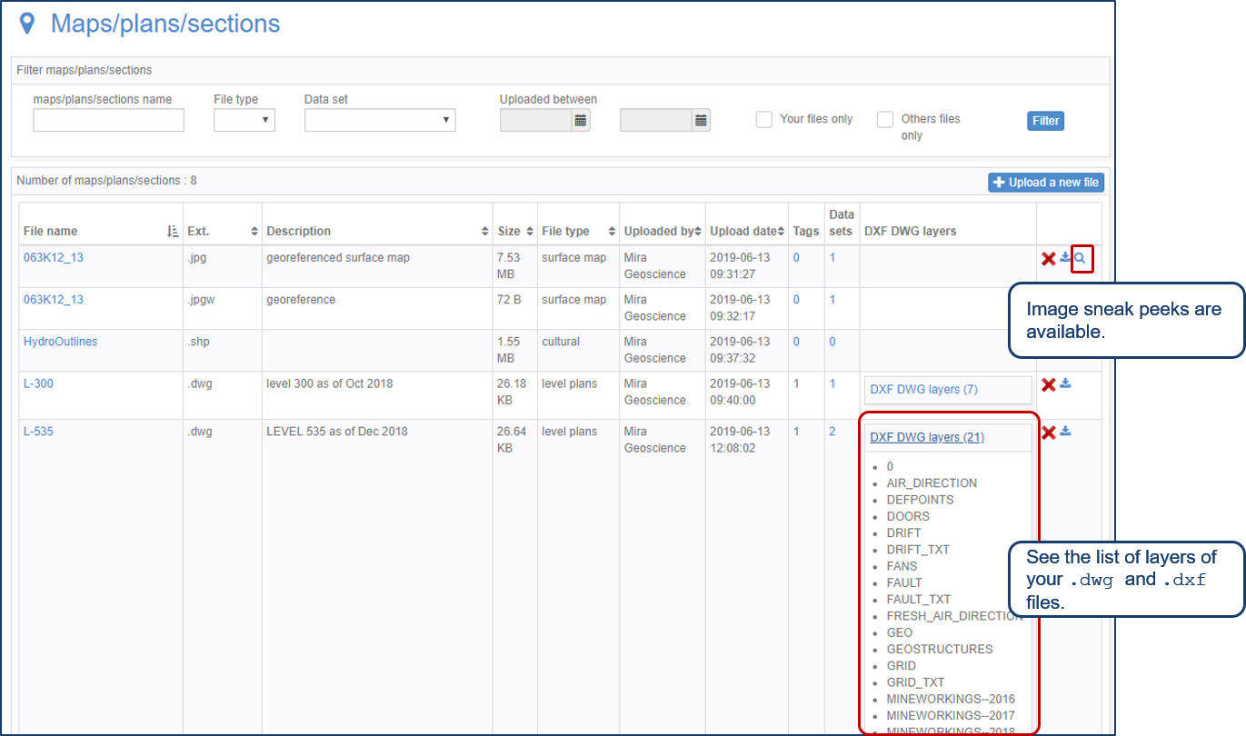
Preview files in the Maps/plans/sections page
See the list of layers of your .dwg and .dxf files. Image sneak peeks are also available...

Sneak peek v19
Emerson-Paradigm released a short video to help users become acquainted with the redesigned interface. Watch this short video ...

Chasing Innovation from the Ground Up
Advances in geoscience are built on ingenuity. Circé Malo-Lalande knows it too well. Discover more about Canadian Royalties' fascinating success story.

The value of using structural restoration tools in exploration modelling – Virtual Lecture
Watch recording - Jean-Philippe shows the use of structural restoration tools in GMS as a modelling tool for structurally controlled deposits...

25 years modelling the earth together
Dedicated to driving technological innovation and excellence in the realm of geoscience. Your success is at the heart of everything we do.

Extending workflows with rapid model generation – Virtual Lecture
Past event - Shaun O'Connor showed how to use the built-in scripting tools for exploratory geological modelling with sparse data...

Using ioGAS in Geoscience ANALYST Pro – Virtual Lecture
Past event, recording available here...

VPmg, VPem1D and VPutility release
VP Geophysics Suite releases: VPmg version 9.3, VPem1D version 4.3 and VPutility version 1.2...

Search for data by spatial extent
This video shows you how to search for data from Geoscience INTEGRATOR by spatial extent...

Q&A with VR Resources
Join us in this exciting conversation with Michael Gunning on how to find success in blue-sky exploration through integrated interpretation of magnetic data and structural geology

Create regions – Crossplot 2D
In GOCAD Mining Suite you can filter data dynamically before creating regions and save the filters as templates for later use...