


Have a look at these short ~2 minute videos and find out how, through Geoscience ANALYST’s viewer, you can import and visualize your 3D seismic data. Also, through Pro, you can plan your next seismic survey with the seismic reflection survey designer.

Previous tips can be found under the Software tip category in our News page and in our Archives page. Join our Virtual Lecture series that showcases technological advancements and provides quick tutorials on Geoscience ANALYST features. More details about this series on our Events page or sign-up to the mailing list.
Latest news

Introducing HiveMap
Capture geological observations quickly, safely, and accurately, both in the field and office with HiveMap...
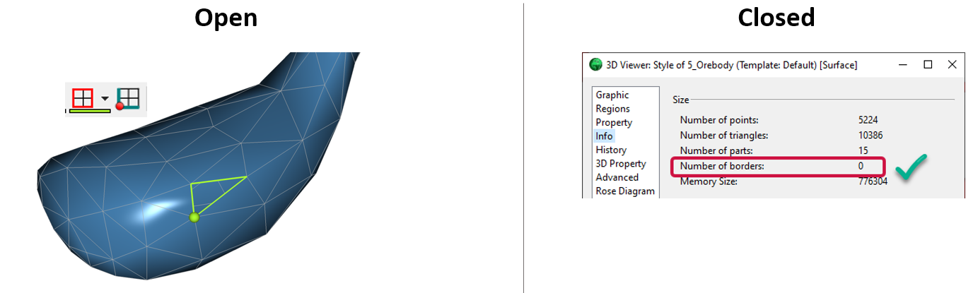
Is the surface opened or closed?
In GOCAD Mining Suite you can easily know if your surface is opened or closed by...

Data set search tools
In Geoscience INTEGRATOR, you can search by data set name or description through the Data set search...

K-means clustering
In Geoscience ANALYST Pro’s v3.3, you can quickly partition your data based on the K-means clustering...

New clustering application in geoapps
geoapps - Exploratory Data Analysis (EDA), rock classification generation, or map alteration footprints

Arbitrary sections
In Geoscience ANALYST visualize your block model in any direction with the new arbitrary section

New Visual Parameter – Contours
In Geoscience ANALYST you can visualize contours on 2D grids. Select your data, specify the contour parameters, or change the colour.
..

3D seismic data and survey designer tools
Coming soon to Geoscience ANALYST, tools for hard rock seismic...
