


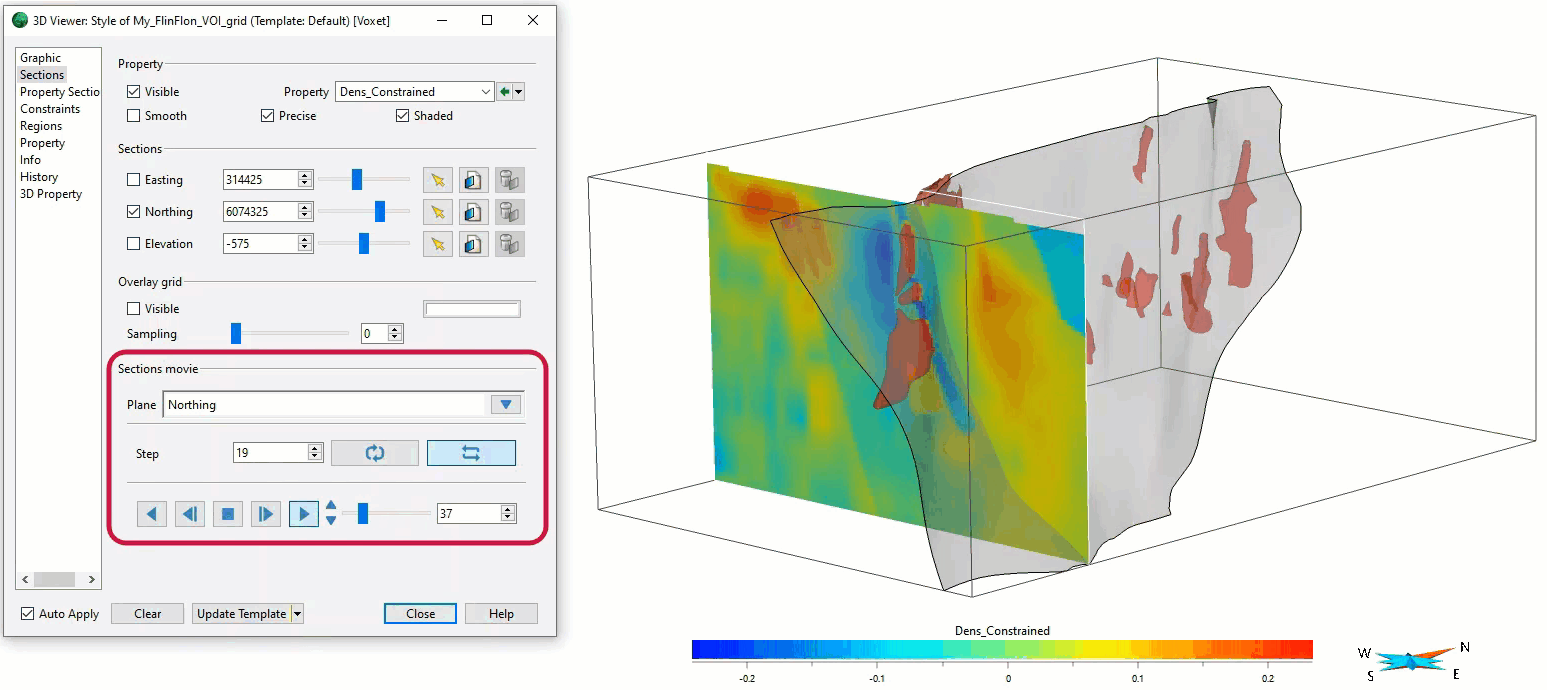
In the Voxet’s Style Editor > Sections, you can create a section animation by specifying which section plane you want to visualize, how many Voxet cells it will move each step, and whether it will play in a loop or swing.
Previous tips can be found under the Software tip category in the News section and in the Archives section of our website.
Latest news

The value of using structural restoration tools in exploration modelling – Virtual Lecture
Watch recording - Jean-Philippe shows the use of structural restoration tools in GMS as a modelling tool for structurally controlled deposits...

New release – Geoscience ANALYST 4.7
Geoscience ANALYST 4.7 delivers a significant set of new tools and performance enhancements. Download it now!

Customizing metadata
Version 3.0 of Geoscience INTEGRATOR has a new layout for data set summaries that allows you to document any general information as custom...

Show and hide
In Geoscience ANALYST you can show and hide everything, individual objects, container groups or drillhole groups...

Data display precision
In Geoscience ANALYST Data Colours panel you can control the precision of the data...

Free mineral exploration data through Geoscience ANALYST
Past event - view here or on our YouTube channel...

Transfer data between objects
In Geoscience ANALYST Pro you can Transfer data between objects...

View neighbourhoods in 3D
You can display your neighbourhoods in Geoscience INTEGRATOR 3D viewer, making it easier to understand spatial distribution of the data.

Women Geoscientists in Canada
We are proud sponsors of WGC, advocates for increased gender balance within geosciences...

Dynamically turn on/off classes in scatter plots
In Geoscience INTEGRATOR, you can turn on/off classes in scatter plots...

Editing property’s colormap
In GOCAD Mining Suite, when you select a property its colormap can be edited...

Using magnetic susceptibility measurements to define mineral exploration targets
Combining magnetic survey data with measured drillcore susceptibility data greatly increases the resolution and geometrical accuracy of the magnetic inversion...