


It’s that easy! Geoscience ANALYST detects the type of file being imported and launches the appropriate import filter.

Previous tips can be found under the Software tip category in our News section and in our Archives section.
Latest news

GEOH5 open format
We developed geoh5 based on free and open-source HDF5 technology because of its many advantages: wide acceptance across numerous data-intensive industries...
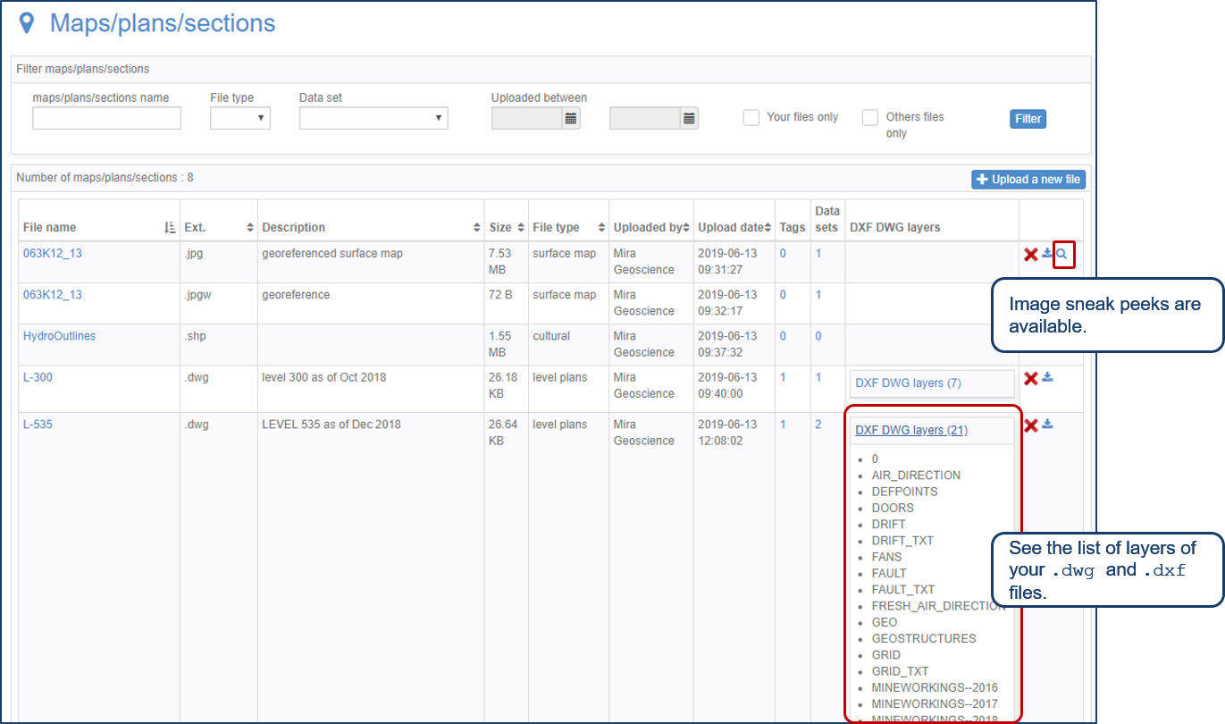
Preview files in the Maps/plans/sections page
See the list of layers of your .dwg and .dxf files. Image sneak peeks are also available...

Creating 3D geological starting model from geological maps and structural measurements
In this lecture, Philippe generates a 3D geological model from a map with structural measurements in Geoscience ANALYST...

New filter options on the File manager and the Maps/plans/sections
In Geoscience INTEGRATOR, you can now find files quickly by using the new extension, tags and uploaded by filters...

Upload global descriptions
In Geoscience INTEGRATOR, add an editable global description during import to save time and reduce errors...

Fourier filters
This new Geoscience ANALYST Pro feature allows you to apply Fourier filters on 2D grids using the basic geophysics tools...

Coordinate system transformations
In Geoscience ANALYST Pro version 4.0, you can apply coordinate system transformations to...

Cloning import templates
In Geoscience INTEGRATOR, cloning an import template provides a ready-to-edit copy without having to build a new one from scratch...

Using magnetic susceptibility measurements to define mineral exploration targets
Combining magnetic survey data with measured drillcore susceptibility data greatly increases the resolution and geometrical accuracy of the magnetic inversion...

Operations on array properties
In GOCAD, this command, found in the Property menu, allows the user to perform various operations (scaling, DC shift...

Geological 3D-GIS query
In GOCAD Mining Suite, you can create points at specific geological contacts for the construction of your geological contact surface...
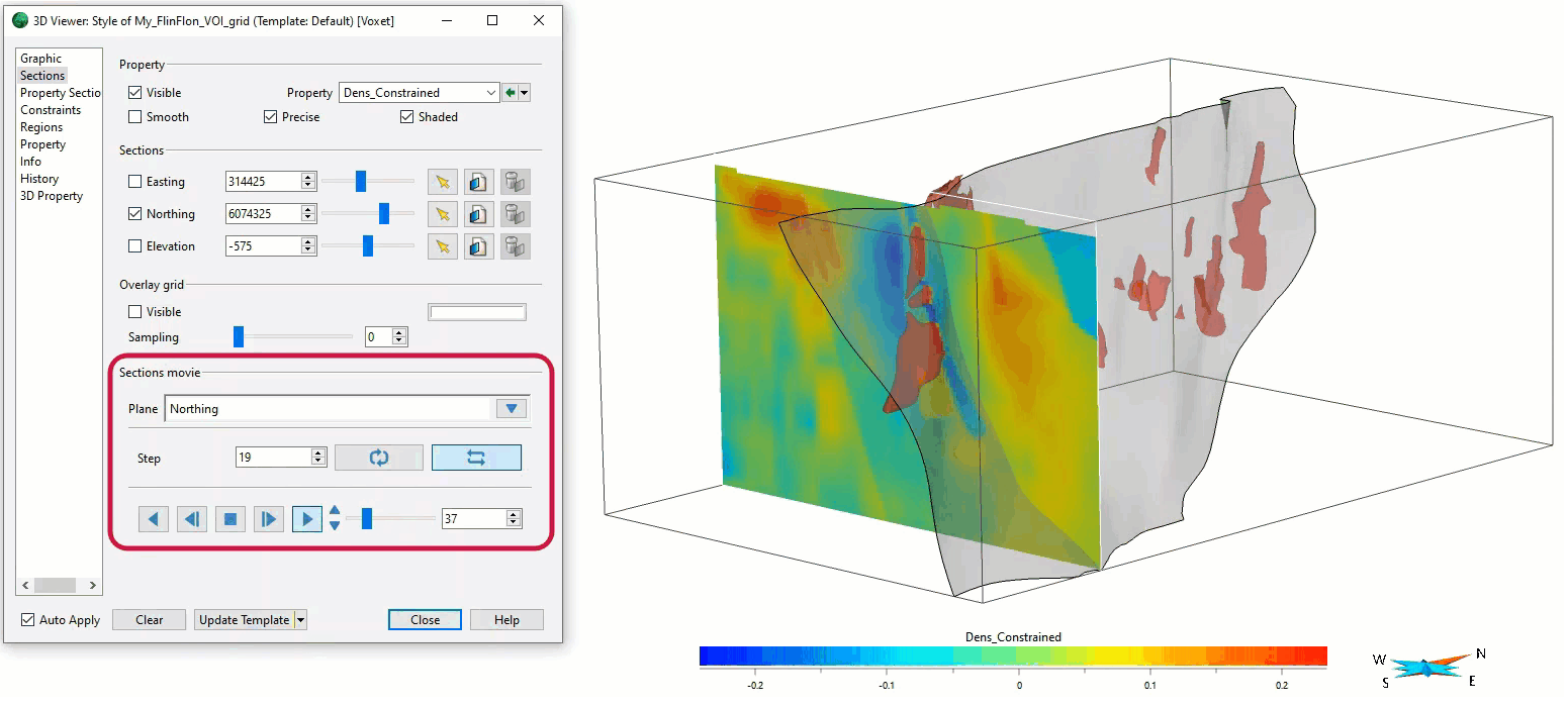
Sections movies
In GOCAD Mining Suite, you can create a section animation by specifying which section plane you want to visualize...