


View your object’s properties in a tabular format with the Tabular Property Viewer ![]() .
.
The coordinates of every node or cell in the object, as well as any associated properties, are displayed as columns. This tool includes a few neat features:
- Atom Picker
 : click on a node in the 3D Viewer and the table will auto-scroll to show that node’s coordinates and property values.
 - Create a PointsSet from Table Selection
 : creates a PointsSet from any highlighted nodes in the table, with the option to copy properties.
 - Right-clicking on columns to sort the table, show/hide properties, and compute their property statistics.

Previous tips can be found under the Software tip category in the News section and in the Archives section of our website.
Latest news

Footprints project public data repository available soon
Project-generated and previously public data, models, and documents from the NSERC-CMIC mineral exploration project, “Integrated Multi-Parameter Footprints of Ore Systems...

Darlot Gold Mine Area, Australia
3D Interpretation of geological, 3D seismic, and conventional geophysical data for brownfields exploration targeting...

Quick selection search tool
In Geoscience INTEGRATOR we added a search box to help you find objects lists such as drillholes, samples, or stations that often have thousands of items...

Adding reference images
You can add reference images to mine fusion models and hazard reports in Geoscience INTEGRATOR to better orient yourself visually.

Customize the Viewport axis labels
In Geoscience ANALYST you can customize the Viewport axis labels
..

Saving views/scenes
You can save up to 10 custom views in Geoscience ANALYST by pressing Ctrl-F(1-10) with the option...
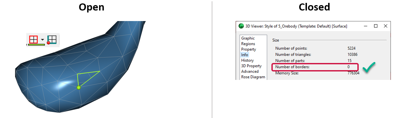
Is the surface opened or closed?
In GOCAD Mining Suite you can easily know if your surface is opened or closed by...

Operations on array properties
In GOCAD, this command, found in the Property menu, allows the user to perform various operations (scaling, DC shift...

Earth model’s themes are renamed
In Geoscience INTEGRATOR v3.7, the “Earth models” theme group is renamed “Models, maps and sections” and the theme’s names were...

New release – GOCAD® Mining Suite V14.5
GMS V14.5 expands the Python API, enhances connectivity with Geoscience ANALYST, and improves interoperability through the open GEOH5 format.

Python applications for geoscientific problems
geoh5py and geoapps - Open format, open source code, and open licensed data! Cannot get any better than that!

Coordinate system transformations
In Geoscience ANALYST Pro version 4.0, you can apply coordinate system transformations to...