


Project-generated and previously public data, models, and documents from the NSERC-CMIC mineral exploration project, “Integrated Multi-Parameter Footprints of Ore Systems: The Next Generation of Ore Deposit Models” will be made publicly available.
The data come from three major ore deposit types in Canada. The first is an Archean orogenic gold system, the Canadian Malartic deposit in Quebec. The data repository contains 35 geochemistry and mineralogy, 6 geophysics, 4 physical property, and 4 structural observation data sets as well as 3D fault and geological contact models.
The second is an unconformity-related uranium system, the McArthur River – Millennium corridor in Saskatchewan. The data repository contains 24 geochemistry and mineralogy, and 6 geophysics data sets.
The third is a porphyry copper-(molybdenum)-(gold) system, Highland Valley in British Columbia. The data repository contains 15 geochemistry and mineralogy, 9 geophysics, 4 physical property, and 1 structural observation data sets as well as 3D fault and geological contact models, alteration zone and other interpreted map domains, and a 3D block model of rock type and inverted density and magnetic susceptibility.
The repository contains numerous files such as data files, core photos, and lab certificates linked to data. It also contains nearly 200 project documents including abstracts, papers, and theses.
An objective of the NSERC-CMIC project was the integration of multi-disciplinary data through machine learning alongside standard statistical techniques. The public data repository from where data, models, and documents can be accessed and visualized is provided by Mira Geoscience’s Geoscience INTEGRATOR data management system hosted by SNOLAB. The open data and use licence will be made available through both a website and Geoscience ANALYST free viewer, providing a simple and cost-free mechanism to access both data and results directly from the database.

© 2019 NSERC-CMIC Exploration Footprints Network. All Rights Reserved - An example of hyperspectral data from Canadian Malartic, that is presented in the paper Gaillard et al. 2018, Ore Geol. Rev. 95, 789-820
Latest news

Arbitrary sections

Meet Polyanna Rowe, PhD

Importing and preparing DC/IP data for inversion with Geoscience ANALYST – Virtual Lecture
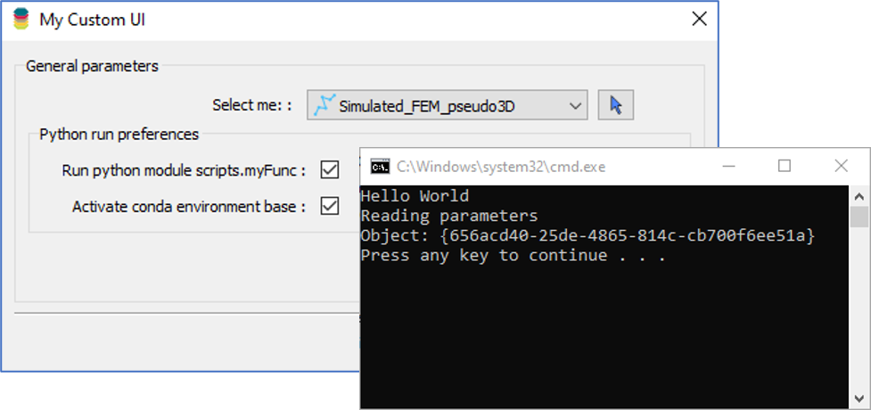
Using Python in Geoscience ANALYST Pro – Virtual Lecture

Georeference images

Default data colour settings
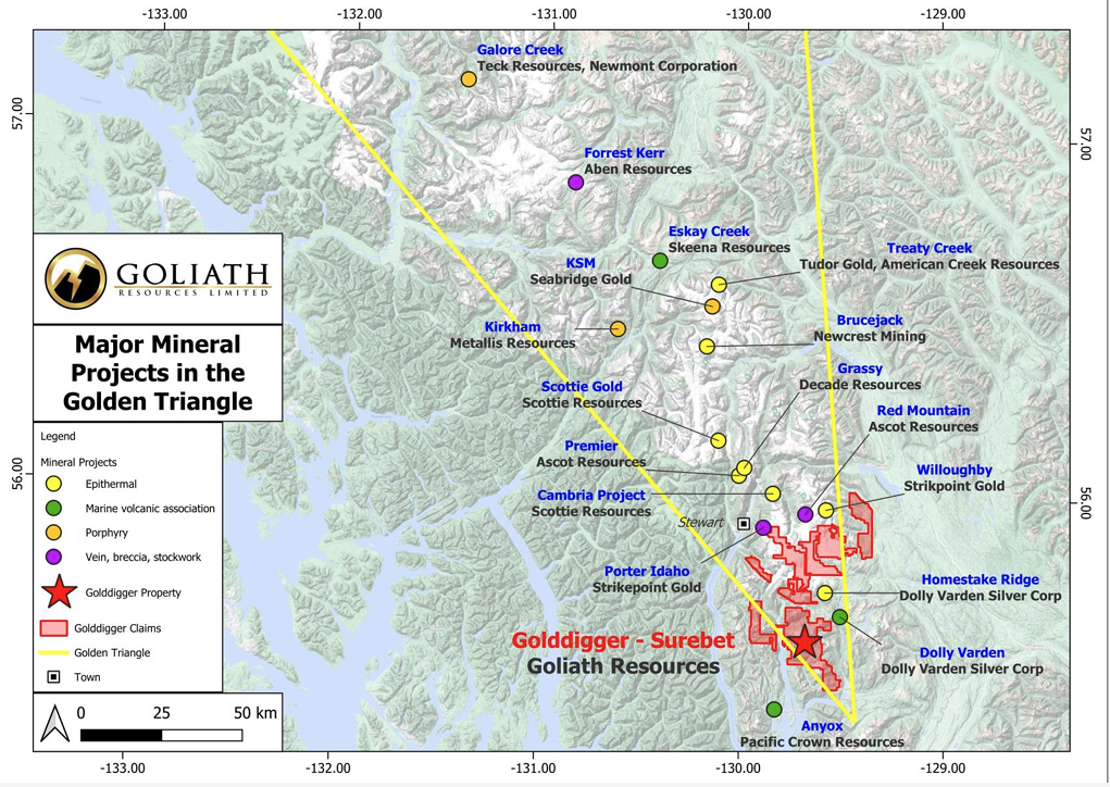
Remote Structural Mapping: A case study from the Golddigger property, BC

Linking viewports

New release – GOCAD® Mining Suite V14.5

Block model volume

Object’s Info
