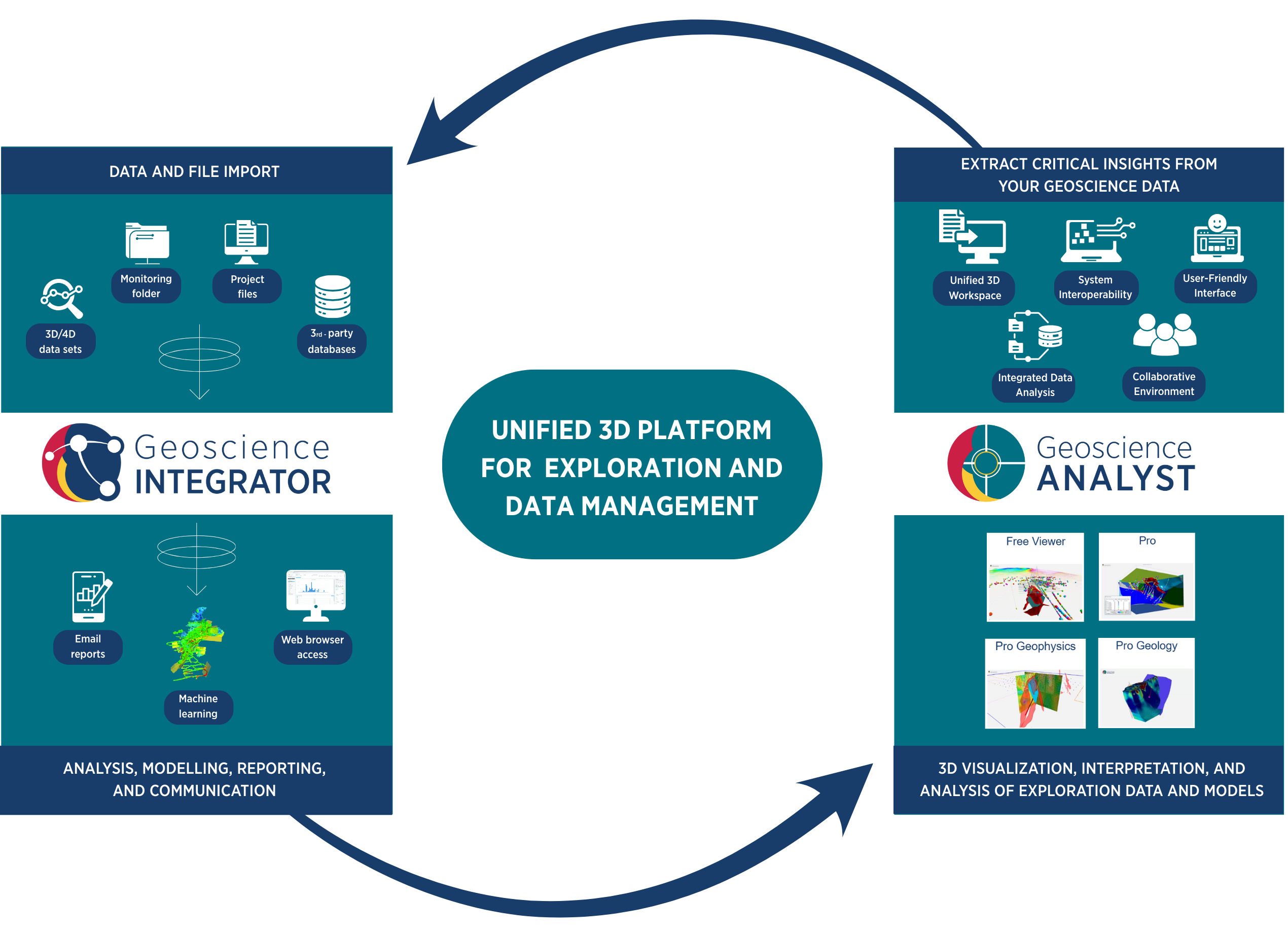
Unlock the potential of your exploration data. Integrate drillhole, geological, geophysical, and geochemical data and models in a single platform, enabling rapid querying, consistent interpretation, and more effective cross-team collaboration.
Geoscience INTEGRATOR
From 3D Exploration to 4D Geotechnical and Mining—One Platform for All Your Data
Data management, query, 3D visualization, and analysis for the integration of 3D exploration and 4D geotechnical and mining data, interpretations, models, and supporting files and documents.
Connecting Data to Insight, and Insight to Action
Ensure data integrity. Use structured data management workflows that enforce standards, validate inputs, and maintain audit trails—giving you confidence in your outputs.
Work from a single, validated source of truth. Avoid data loss, duplication, and errors with centralized governance, version control, and built-in validation tools.
Adapt your data structure to match your workflow. Configure schemas, relationships, user access, and data integration rules to align with your operational logic—so the system works the way you do.
Query data with precision and speed. Use advanced search and filtering tools to explore complex 3D and 4D datasets—turning raw information into actionable insights while maintaining consistency and traceability.
Collaborate more efficiently across teams and disciplines. Work in an integrated, shared 3D platform with consistent, live access to all project data and interpretations.
Streamline mining workflows with integrated 3D and 4D datasets. Maintain consistent models across space and time, enabling data-driven insights, predictive analytics, and automated reporting.
Explore Geoscience INTEGRATOR
Geoscience INTEGRATOR
For Exploration Projects

Geoscience INTEGRATOR
For Geotechnical and Mining Projects

Streamline geotechnical and mining operations with integrated 3D and 4D data management. Maintain spatially and temporally aligned models, enable advanced analytics and machine learning, and automate reporting for faster, more confident decisions.
Would you like to see Geoscience INTEGRATOR in action?
Related resources
Geoscience INTEGRATOR 4.1 unveils a range of new features and improvements designed to boost performance and enhance user experience.
A robust workflow for regional porphyry targeting; Application to the QUEST-South project area in southern British Columbia
Mitigating data science and statistical challenges is crucial to integrate machine learning into the everyday targeting tasks of exploration geologists.
Mira Geoscience receives the 2023 AME Innovation Award
John McGaughey, Mira Geoscience's President, has been selected for the 2023 AME Innovation Award for leading the development of GEOH5.
GEOH5: A Framework for Geoscience Data and Model Portability
Used by thousands, GEOH5 is the open-source data structure that is taking down the interoperability barriers and revolutionizing...
Area-select in Viewport
In Geoscience ANALYST you can multi-select data in the Viewport to highlight them in the Data Table.
Getting started with the Python geoh5py
Past event, view here or via our YouTube channel...
Double-click to save clicks
In GOCAD you can visualize double-click an object in the 3D Viewer to quickly and easily access its Style and Secondary Style Toolbar...
Have you Scene this?
In GOCAD Mining Suite v19, you can save the view as a Scene by right-clicking on the 3D Viewer > (Scene) Save As…
A YouTube Channel about 3D modelling
We have quite a few how-to and tutorial videos lined up on YouTube highlighting our earth modelling, interpretation, and data management software for the construction of plausible geological models.
Removing trend from data
In Geoscience ANALYST v3.0, you can remove regional trends to potential fields data...
Darlot Gold Mine Area, Australia
3D Interpretation of geological, 3D seismic, and conventional geophysical data for brownfields exploration targeting...
2D minimum curvature gridding
With Geoscience ANALYST Pro module, you can interpolate numerical data from points, curves and surfaces...


