Geoscience ANALYST

Empowering Informed, Data-Driven Geoscience Decisions

Geoscience ANALYST is a powerful software solution for visualization, communication, analysis, and integrated interpretation of multi-disciplinary geoscience and mining data and models.

Extract critical insights from your geoscience data

Import, visualize, annotate, save, and distribute geoscientific data types and models in a single 3D environment for free.
Interoperable with a wide variety of 3D exploration and modelling packages, including GOCAD Mining Suite.
Easily explore, interpret, and interact with complex geological models harnessing the power of intuitive 3D tools.
Integrate multiple data sets, including geological, geophysical, geochemical, and geotechnical data for comprehensive analysis.
Navigate the user-friendly interface with ease, whether you are a seasoned geoscientist or new to the field.
Share and communicate your insights and collaborate with colleagues and other stakeholders effortlessly.

Geoscience ANALYST is available in four different product options

These product options complement each other, extending the software's technical capabilities

3D Viewer

The free Geoscience ANALYST 3D viewer allows you to visualize and communicate integrated, multi-disciplinary geoscience and mining data and models.

Pro

Geoscience ANALYST Pro offers additional functionality for object creation, editing, data processing, interpretation, and targeting.

Pro Geophysics

Geoscience ANALYST Pro Geophysics offers advanced, yet easy-to-use, geologically-constrained geophysical modelling and inversion.

Pro Geology

Geoscience ANALYST Pro Geology provides an enriched geologist’s toolkit, including AI methods for geological interpretation.

Are using our software and have questions?

Latest news

Software releases
January, 17 2025

New release – Geoscience ANALYST 4.5

Geoscience ANALYST 4.5 brings performance improvements and key new features to all modules. Download it now!
Read more
Geoscience ANALYST
February, 11 2021

15 tips in 15 minutes – Geoscience ANALYST Free Viewer

Past event, view here or on our YouTube channel...
Read more
Developer’s sandbox
September, 08 2023

GEOH5: A Framework for Geoscience Data and Model Portability

Used by thousands, GEOH5 is the open-source data structure that is taking down the interoperability barriers and revolutionizing...
Read more
Case studies
August, 16 2023

Chasing Innovation from the Ground Up

Advances in geoscience are built on ingenuity. Circé Malo-Lalande knows it too well. Discover more about Canadian Royalties' fascinating success story.
Read more
April, 03 2019

Bounding boxes in the viewer

Coloured bounding boxes are used to highlight volumes in the Viewport: A purple box surrounds your current selection...
Read more
September, 02 2019

Creating properties within the script editor

In GOCAD, properties can be created within the Property Script Editor by typing the new property name in the script and then clicking Define Variables…
Read more
September, 07 2020

Linking viewports

In Geoscience ANALYST you can synchronize the perspective of all visible Viewports to zoom, pan, and rotate them all at once...
Read more
GOCAD Mining Suite
April, 08 2021

GOCAD Mining Suite – A geological modelling powerhouse

Past event, recording link available here...
Read more
Geoscience ANALYST
May, 05 2021

3D seismic data and survey designer tools
Coming soon to Geoscience ANALYST, tools for hard rock seismic...
Read more
September, 16 2019

New mine production theme

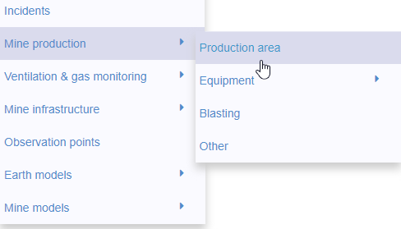
In Geoscience INTEGRATOR, version 3.2 has a new theme called Production area. It’s designed for stope, mining room, or drawpoint data...
Read more
Mineral systems interpretation and targeting
July, 13 2022

Generating exploration models from a detailed structural interpretation and Artificial Intelligence

This approach uses the comment field of the logging table to extract general topics that can then be used as learning features in a supervised machine learning classification approach.
Read more
February, 03 2019

Organizing files as data sets

In Geoscience INTEGRATOR, a data set is often composed of a group of files of various formats along with metadata. These can be grouped...
Read more

Please contact our team for additional information about our products and services